
 Yesterday we took a more detailed look at the types of observations that are being planned for the Europa/Jupiter System Mission (if it's selected as the next flagship mission). The Final Report for the Jupiter Europa Orbiter also provided us with details of the encounters planned in the current reference trajectory for the mission. One of the types of observations that I want to talk about today is sub-surface sounding using the Ice Penetrating Radar (IPR). This is a type of observation that has never been done at Io and I have become curious as to what IPR (or a similar instrument) could see if it were turned at Io.
The Ice Penetrating Radar would work in a similar fashion to the MARSIS and SHARAD instruments currently at Mars on board Mars Express and Mars Reconnaissance Orbiter, respectively. Using a pair of antennae, IPR would emit pulses of high-power radio waves at the surface of the target body. These waves would first bounce off the surface and then structures in the sub-surface which become more difficult to detect the deeper you get as the signal returned becomes fainter. Basically, when the radio waves first encounter the surface, some of the waves are bounced back to the spacecraft, while others bounce down into the sub-surface, where it will then encounter another reflecting surface. This layer (or fault plane) will then bounce radio waves upward back toward the spacecraft or further into the sub-surface. This process continues until the amount of signal from a sub-surface layer doesn't rise above the noise level or is interfered with by other signals coming back.
The IPR will have two frequency modes: a 5-MHz (60-m wavelength) deep mode and a 50-MHz (6-m wavelength) shallow mode. When JEO is orbiting Europa, the shallow mode would be used to identify near-surface pockets of water while the deep mode would be used to search for the interface between the ice crust and the liquid water ocean beneath. At Europa, the IPR is expected to be able to sense layers as deep as 3 km using the shallow mode and 30 km using the deep mode. There are trade-offs to using each mode. While the 5-MHz mode can sense much deeper into the Europan sub-surface, it has a lower vertical resolution, 100 meters. The 50-MHz mode can not penetrate as deeply, but the vertical resolution in this mode is 10x better, 10 meters. So the shallow mode would be able to over thinner layers and smaller structures than the deep mode could. So the mode used on a particular orbit of Europa would need to be chosen based on what the scientists are trying to look for: small pockets of water near the surface or a broader perspective on the thickness of the water-ice crust. IPR also has a raw data mode, which would record the high-bit rate, unprocessed data for processing on the ground (rather than in the instrument electronics). This mode would be used for high-science value targets but the JEO final report doesn't provide information on which wavelengths would be used (at the moment I presume both).
The IPR would be used during two of the Io flybys, Io-1 and Io-4 - the two low-altitude encounters currently planned. For both encounters, the raw data mode would be used for the two minutes surrounding closest approach, providing a 1000-km long swath across Io's surface. During these encounters, the Laser Altimeter would also be used to help verify the surface heights measured by IPR. Now, obviously, near-surface properties of Io and Europa's crust are quite different. Io's near-surface should consist of a mix of basaltic rock and sulfur and sulfur dioxide ices. These differences in the material properties of their lithosphere should result in differences in the depth IPR can penetrate into Io's crust compared to the values given in the Final Report for Europa orbital science. Now, the best figures I could find for radio sounding penetration depths in basalt suggests that IPR should be able to sense layers as deep as 50-wavelengths below the surface. This would translate to 300 meters for the 50-MHz mode and 3 km for the 5-MHz mode. I am not sure if the vertical resolution also scales (1/10th of the ice penetration depths). For this discussion, I will presume that it doesn't. If any of these figures seem incorrect, please let me know so I can post a correction.
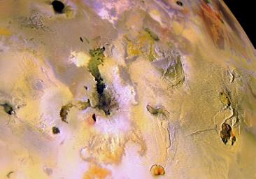
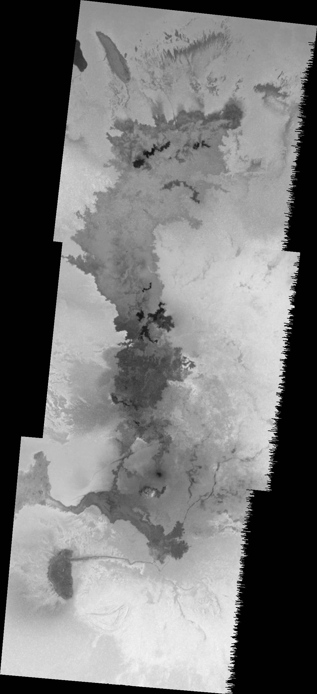
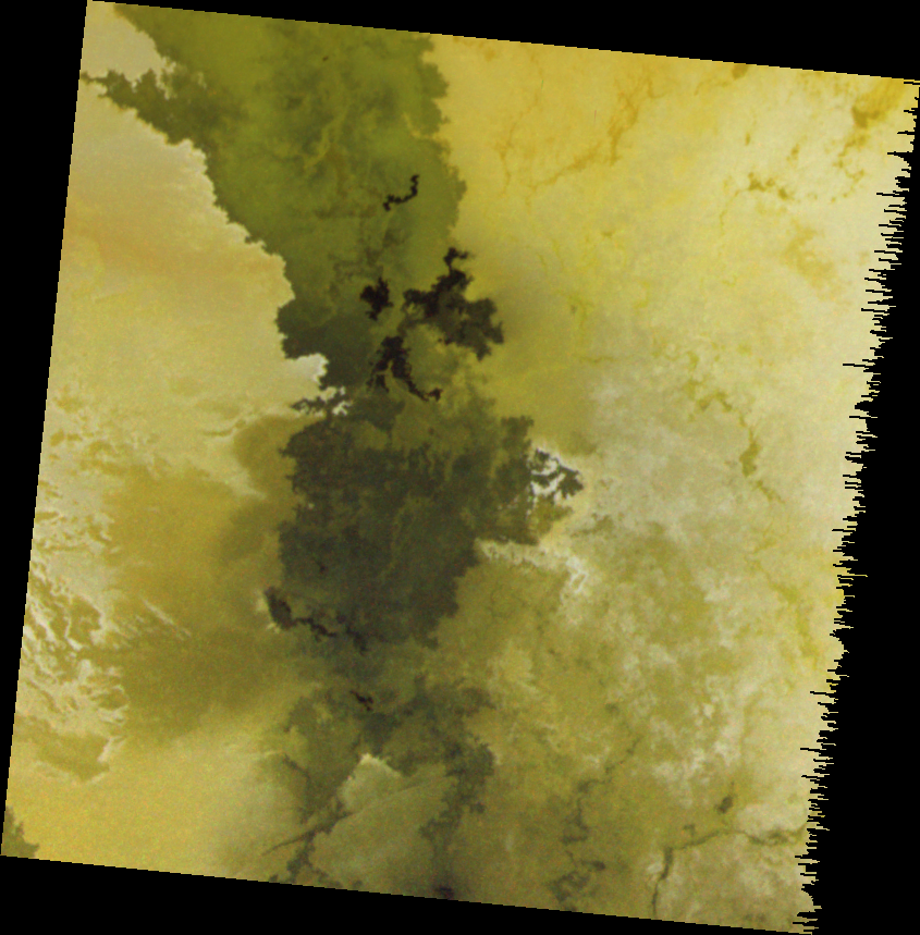
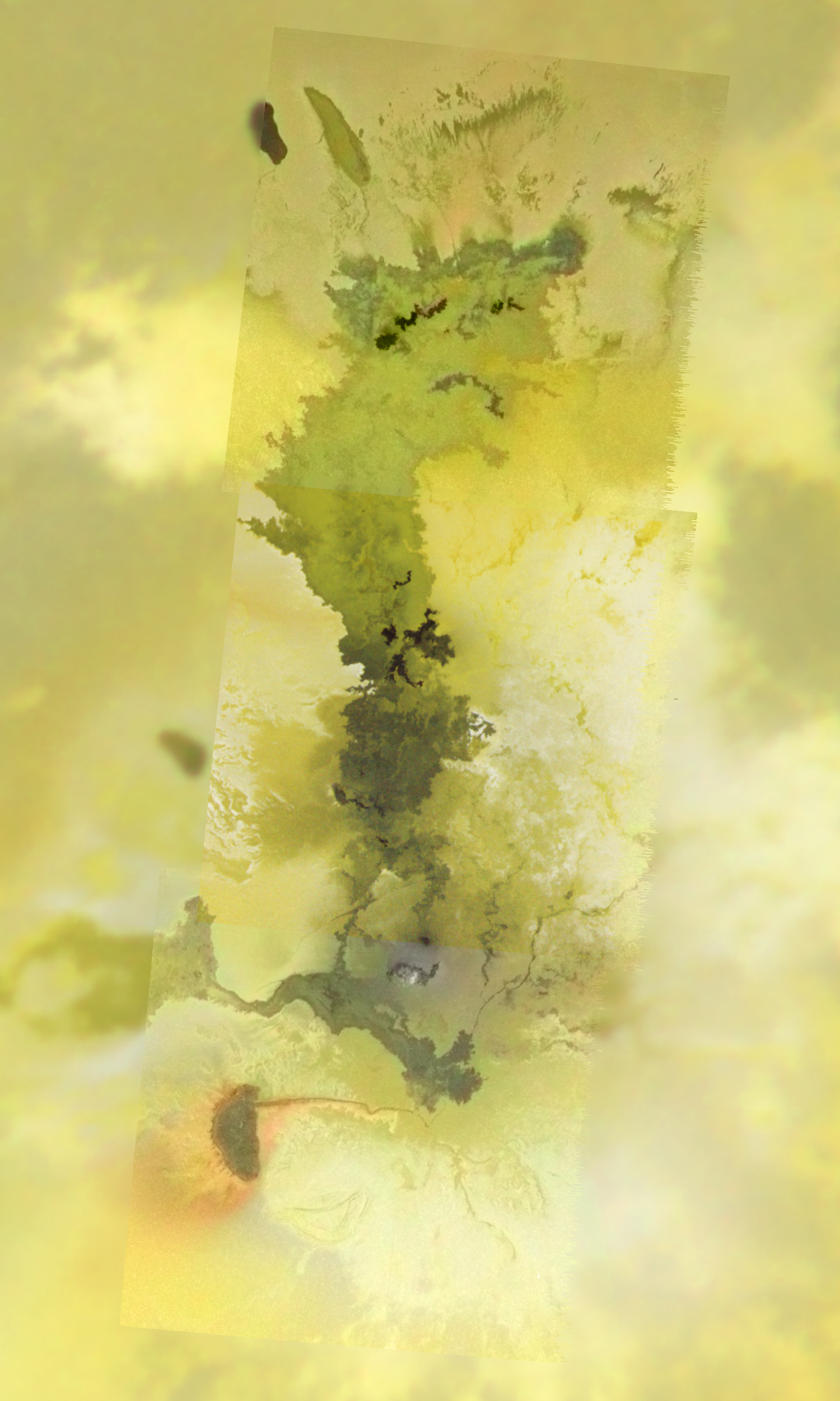
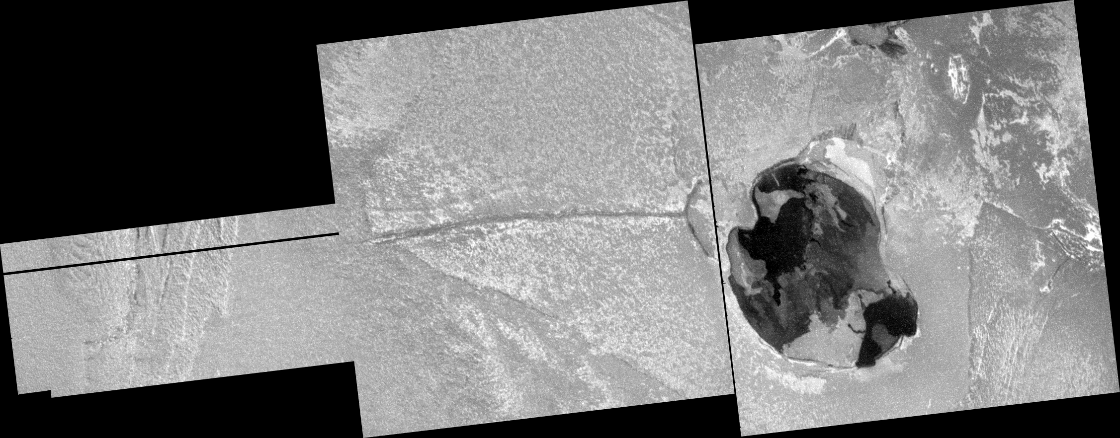
 Now with those depths and vertical resolutions, what kinds of structures would IPR see? Let's take a look at two potential swaths, shown at left. During the two minutes surrounding closest approach during the July 2026 Io-1 encounter (300 km at C/A), the JEO spacecraft would pass just north of an unnamed active volcano, then travel southeast across the Maui portion of the large Amirani flow field, then across an active patera thought to be the source vent for Amirani, and then over the older flows at Amirani as well as the plume deposit from the volcano. After passing over Amirani, JEO would continue to travel southeast, finally passing over the 6-km tall mountain Monan Mons. During the two minutes surrounding closest approach during the December 2026 Io-4 encounter (75 km at C/A), JEO would pass over four paterae, including two active volcanoes: Malik Patera and Altjirra Patera (the two dark patera under the flight path, left and right respectively). No topographic structures beyond these paterae are under the flight path. The flight path would also cross a couple of old flow lobes associated with Arusha Patera.
Using the 5-MHz band, assuming a penetration depth of 3 km and a vertical resolution of 100 meters, IPR could look at tectonic structures in the upper crust as well as search for shallow magma reservoirs. As far as tectonic structures go, IPR could look at the faults that underlie the mountain Monan Mons. This mountain is thought to have been uplifted by imbricate thrust faulting, and IPR could try to look for these faults to test this hypothesis. IPR could also look at the connection between tectonism and volcanism by look at how deeply paterae bounding faults penetrate. Do these faults reach as far down as the shallow magma reservoirs? It should be pointed out that most of these reservoirs are expected to be located at depths between 4 and 10 km, so they maybe too deep for IPR to detect. However, Leone et al. 2008 reported that Prometheus' shallow reservoir could have a rough as shallow as 3 km below the surface, so it might be possible for IPR to detect magma bodies below the surface of Io.
Using the 50-MHz band, assuming a penetration depth of 300 meters and a vertical resolution of 10 meters, IPR could examine near-surface layering of sulfur and sulfur dioxide with basaltic lava flows, comparing the depth of these layers with evidence for sapping. A 10-meter vertical resolution might be enough to resolve layering from individual eruptions, though it would be insufficient to resolve individual flow lobes, which would be on the order of one-meter thick. The 50-MHz band could be useful for looking at layering in the plains of Io, which would allow scientists to better understand how they've been built up over time.
As you can see, both IPR modes could be very useful for examining some important science questions for Io, particularly the origin of mountains and paterae by examining sub-surface structures hidden by the surface layer of sulfur and sulfur dioxide frosts and ices. IPR can also examine how fractured Io's crust really is. If a choice had to be made between the shallow and deep modes on each encounter (meaning the raw data mode doesn't use both bands), I think it would be better to use the deep mode during the first encounter over Amirani, due to its usefulness for exploring deep structures such as mountain-forming faults and shallow magma reservoirs. For the other encounter, both modes could be used, but I think the lack of mountains, and the use of deep mode to explore the deeper structure under Amirani, would make the shallow mode a bit more useful for exploring how the plains are built up and for looking at the shallow sub-surface of the volcanoes in this region. Regardless of which mode is used, it would be very useful if context images from the wide- or medium-angle camera were acquired during closest approach so that structures observed by IPR and the Laser altimeter can be correlated with structures on the surface.


