
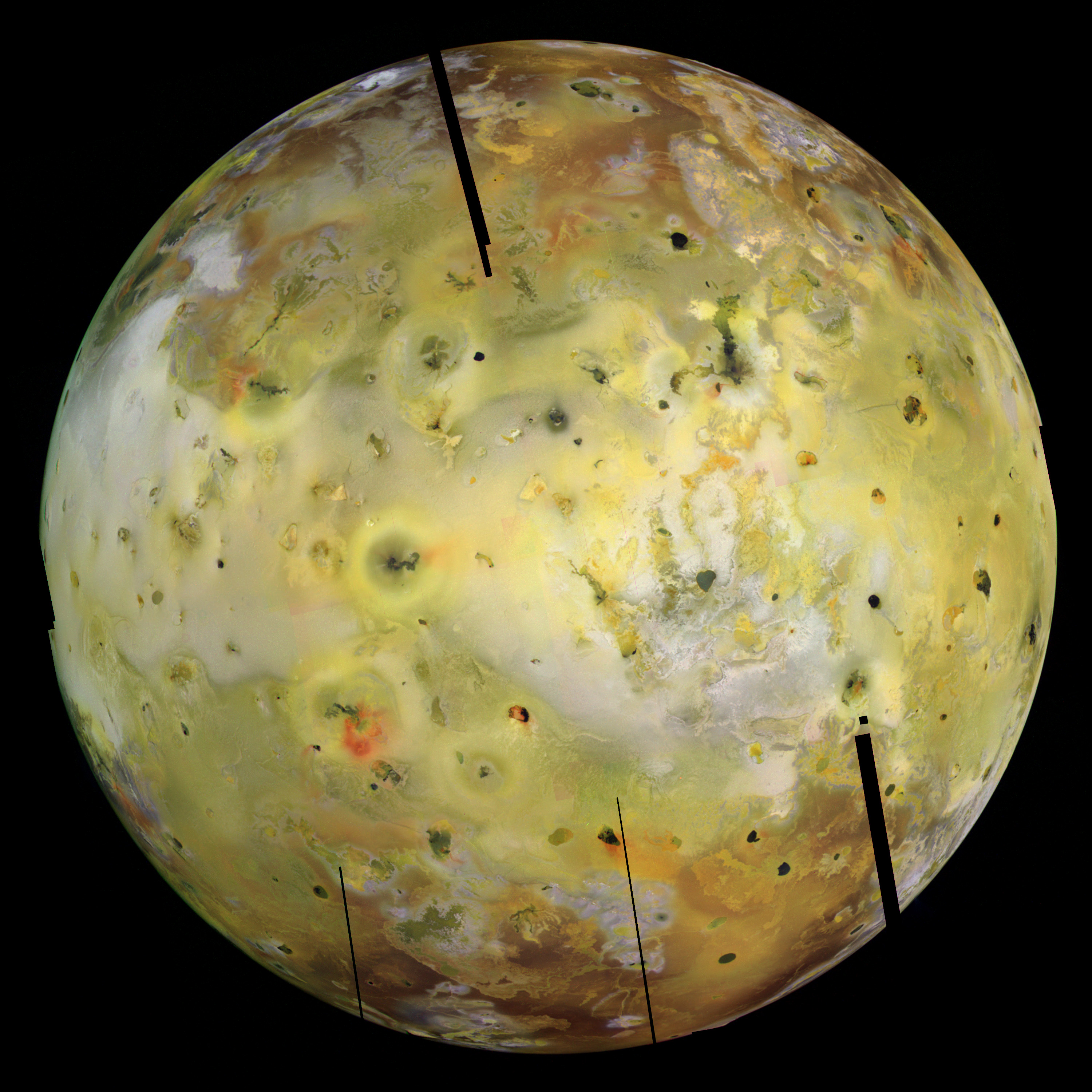
Paul Schenk has posted some new, high-definition videos on Youtube showing the topography of various surface features across the four Galilean satellites. These videos were created for a conference/celebration going on in Padua starting today, the IAU Symposium 269: Galileo's Medicean Moons - Their Impact on 400 Years of Discovery. Schenk's videos can be found online at his Youtube channel, GalSat400. These videos are based on photoclinometry and stereo imaging derived from Galileo images. Photoclinometry uses changes in the topographic shading of a features to determine local slopes, and thus topography. Stereo imaging uses pairs of images taken at different viewing angles to determine topography. The latter example are often depicted as stereo pairs or anaglyphs. For Io, these videos include flyovers of Tohil Mons based in part on a high-resolution mosaic of mountain from Galileo's flyby of Io during orbit I32, Hi'iaka Montes from I25 data, and the Pillan flow field from I24 data (not posted yet but I definitely look forward to Paul getting that online). For your convenience, those videos are also below. Paul has also post videos using high-resolution Galileo mosaics for the other Galileans. Of these other videos, I kinda like the flyover of Manannan crater on Europa. This relatively small impact crater looks crater-ish from a distance, but up close, when you look a the topography of the feature, you can see that the thin ice shell and ductile layers of that shell have mangled that crater out of all recognition.
Definite check these videos out!
Tohil Mons, Io (high-resolution)
Liftoff from Hi'iaka Montes
Link: Youtube - GalSat400's channel [www.youtube.com]
Link: Galileo and Padova - 1610-2010 Celebration (New Videos) [stereomoons.blogspot.com]
Showing posts with label Tohil Mons. Show all posts
Showing posts with label Tohil Mons. Show all posts
Wednesday, January 6, 2010
Monday, October 19, 2009
Tohil Mons movie @ Stereo Moons
 LPI researcher Paul Schenk has posted a set of four movies showing examples of topography from each of the four Galilean satellites on his blog, Stereo Moons. The release of these movies is meant to be part of the commemoration of the 400th Anniversary of the discovery of these moons by the astronomer Galileo.
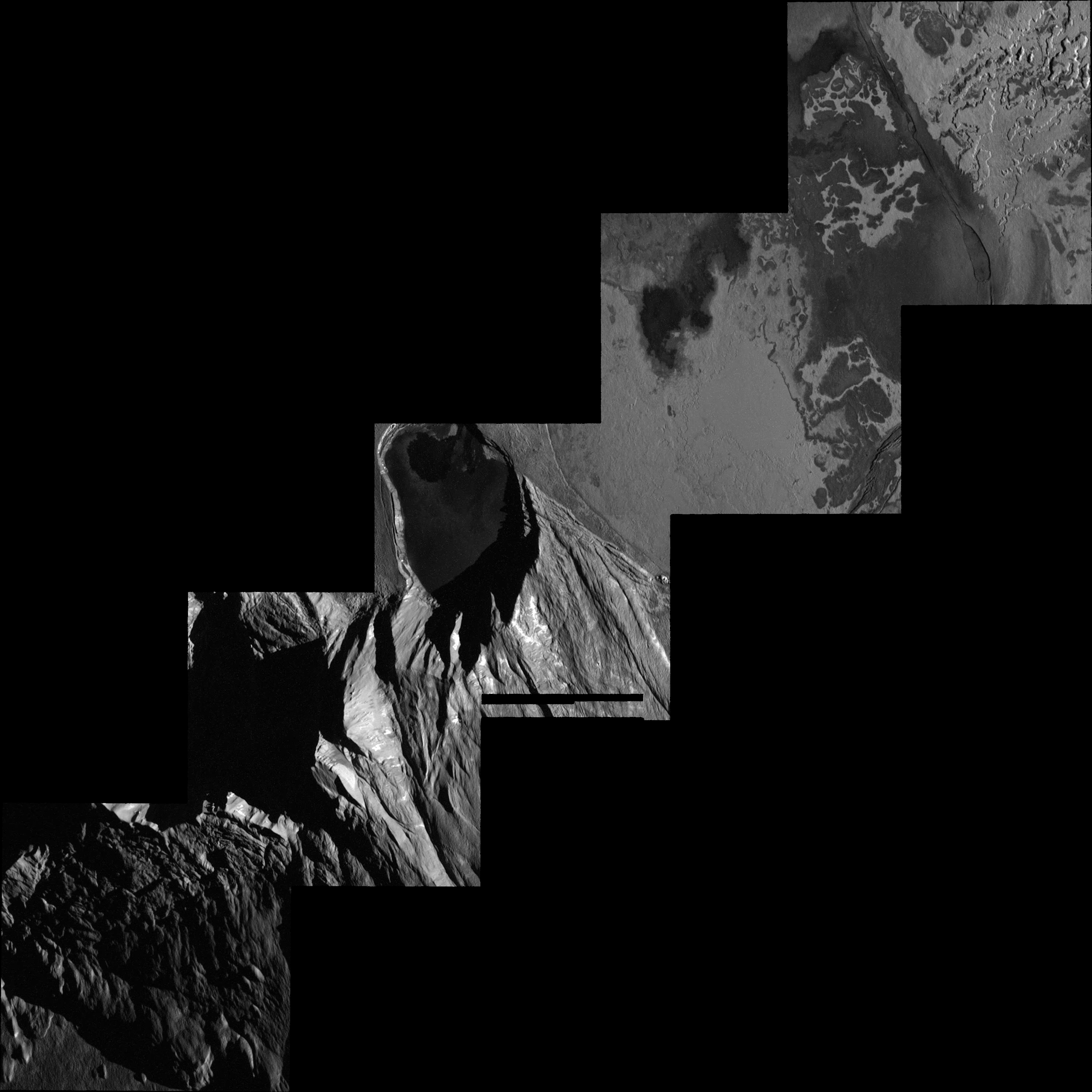
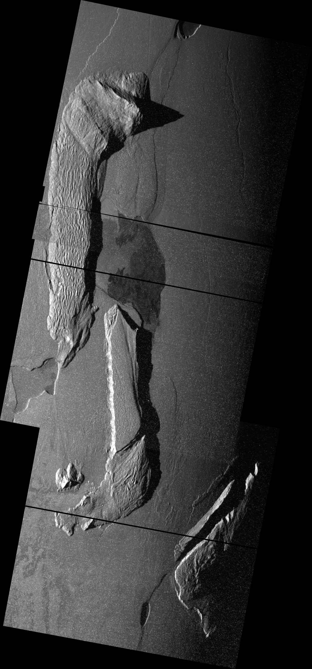
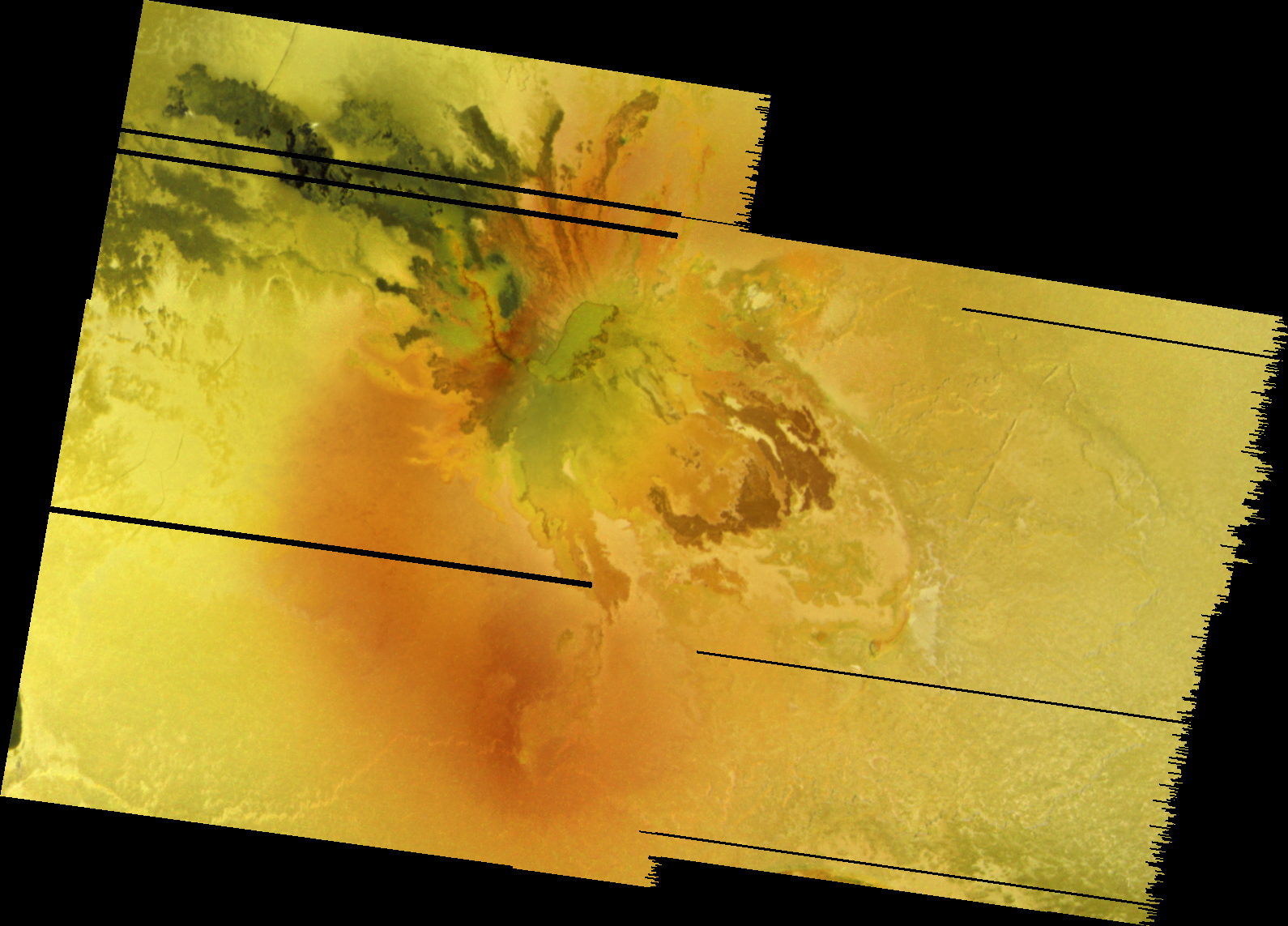
The Io example covers the mountain Tohil Mons and two nearby volcanoes, Tohil Patera and Radigast Patera. This mountain can be seen at left in a screenshot from my local version of Celestia (which includes real and faked topographic information for Io). The topographic data Schenk uses is based on a combination of stereo data from two low-phase angle mosaics from Galileo's I24 and I27 encounters as well as shape from shading from a mosaic of Tohil taken when the mountain was much closer to the dawn terminator during the I32 encounter (like the geometry shown in the Celestia screenshot). The mosaic was colorized using two mosaics: a regional mosaic of Culann Patera and the northern portion of Tohil Mons from I25 and a global color mosaic from C21. Schenk's movie beautifully shows a mountain at a significant stage of degradation but is still able to reach to spectacular heights. Part of the degradation of this mountain is the result of nearby volcanism at Radigast and Tohil Paterae. Tohil Mons was perhaps the most extensively imaged mountain on Io by the Galileo spacecraft, and even higher resolution data is available, and Schenk promises higher resolution topographic information and a higher resolution movie is forthcoming.
Of the other three movies, my favorite has to be Ganymede. That movie covers portions of Arbela Sulcus and the older terrain on either side of it. I like it because the topography and albedo information seems much more coherent. Europa, for its supposed smoothness, always looks like a jumbled mess when you look at it up-close (with exaggerated topography). Callisto, well, Callisto has too many craters.
Very cool movies and I hope you all check it out. Do it. Do it NOW!!! :-D
Link: Galileo: 4 Moons at 400 Years [stereomoons.blogspot.com]
Subscribe to:
Posts (Atom)


