
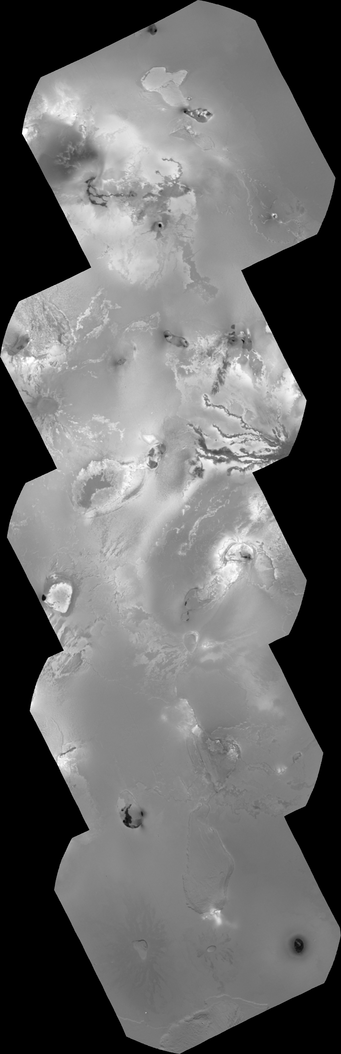
 Today I got finished processing three additional mosaics from Voyager 1 images. The first two use narrow-angle camera images acquired shortly before the encounter, and the other uses wide-angle camera images during the spacecraft's closest approach to Io on March 5, 1979.
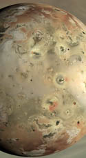
The first mosaic uses images acquired as support imaging for the Photopolarimeter Subsystem on Voyager. The PPS acquired a north-south scan across the center of the disk to measure information about Io's surface texture and bond albedo. Click here to see the ISS-NA mosaic at full-resolution. This mosaic runs from Acala Fluctus, across the flows that radiate out from Ra Patera, Kava Patera, and ends on the northern flanks of Euboea Montes. This mosaic cross high-sun terrain, so albedo markings are emphasized over topographic shading, though some mountainous features, such as Iopolis Planum and Euboea Montes, both in the bottom frame, can be seen. This mosaic has a resolution of 610 meters per pixel.
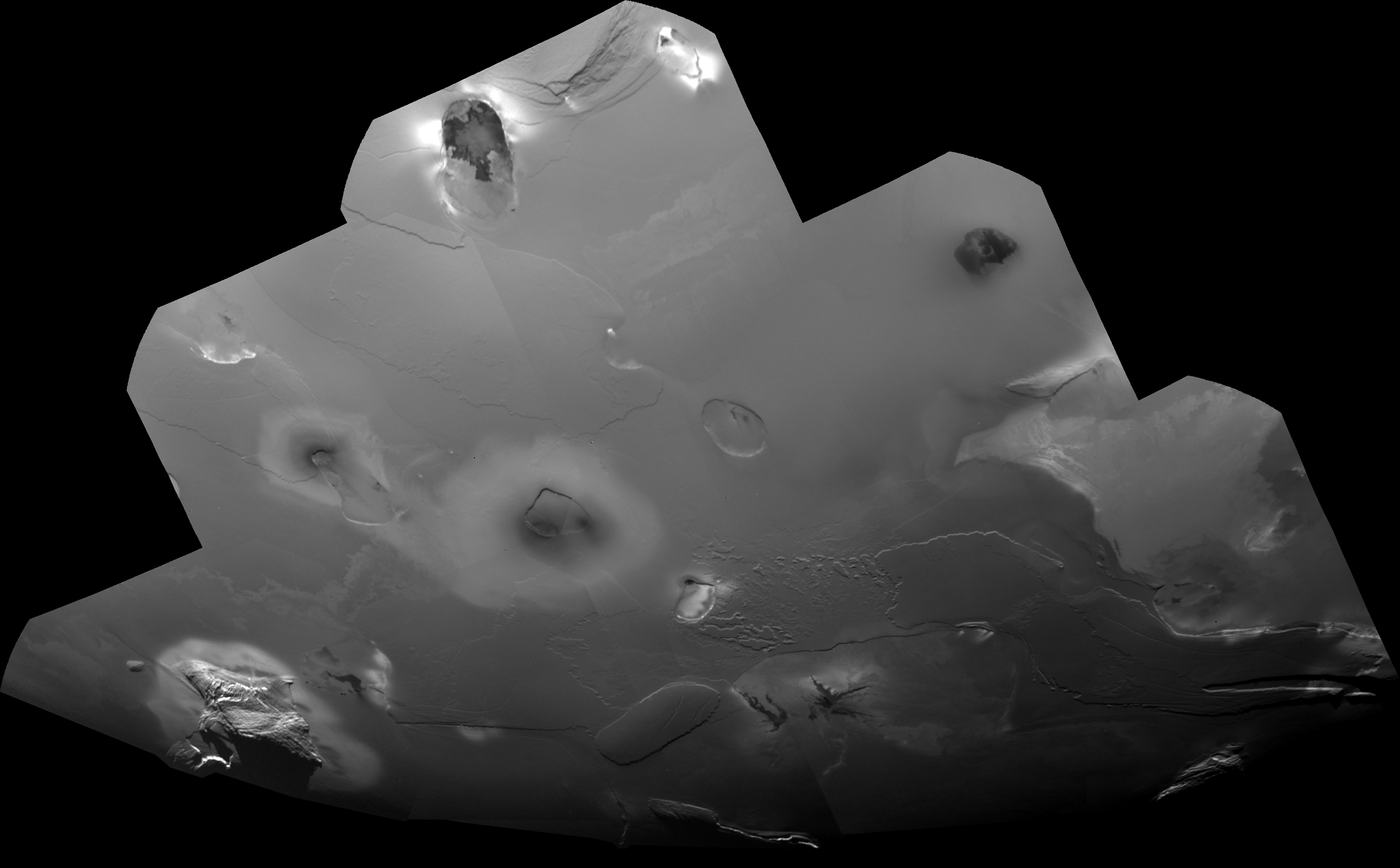
 The second mosaic uses images that were part of a high-resolution mosaic design over the south polar region of Io. Click here to see this ISS-NA mosaic at full-resolution The terrain here is much closer to the terminator, so more topographic features are clearly visible. For example, several tall mountains are visible along the terminator, the line between day and night, including Haemus Montes at bottom left. Some of the low plateaus visible, such as Echo Mensa (the rounded rectangular mesa at center bottom) and the western part of Nemea Planum (to the northeast of Echo) appear eroded, potentially from sapping of Sulfur dioxide, though no evidence of recent sapping, like bright material along the base of the low cliffs at these features, is visible. Such evidence can be more clearly seen at the eastern end of Nemea and in a fracture to the west of Echo.
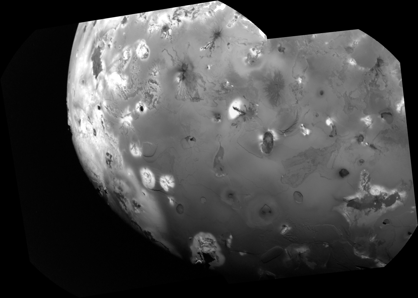
 The final mosaic consists of two, violet-filter wide-angle camera images acquired during Voyager 1's closest approach to Io. Click here to see this ISS-WA mosaic at full-resolution. These two images show similar terrain to the other mosaics I've posted here in the last few days, but what makes these images exciting to me is what you can see along the limb on the left side of the mosaic. This region shows feature that I had thought had only been seen at much lower resolution. These images have a pixel scale of 2 km/pixel, whereas the previous best I could find has a resolution of around 9.5 km/pixel. So obviously, this appears to be a significant improvement. Among the features visible is the Masubi flow field (at lower left, also see the cropped image at the top of this post), a semi-persistent volcanic plume source. This feature is notorious for having plumes that jump around along the length of the flow field as well as having plume with multiple source vents (such as during the Voyager 1 and New Horizons encounters). In this mosaic, you can see a plume deposit around the main vent, a V-shaped flow field (not quite sure where the source patera, but I have an idea). There appears to be a disconnect between the flow to the south and the main V-shaped field, not sure how real that is, or if the flow connecting the two was quite narrow, akin to the connection between the Amirani and Maui flows fields. These WACs seem to close the notorious gap between the Voyager and Galileo high-resolution coverage that existed between 40 and 60 West, at least south of the equator, which I am excited to see.
Tomorrow, I will close out my coverage of the 30th Anniversary of the Voyager 1 flyby by looking at the post-Voyager perspective on Io and how it compares to our view now.


No comments:
Post a Comment