
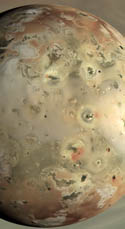
 A new, Io-related paper was published in the October 30 issue Journal of Volcanology and Geothermal Research titled, "Volcanic history, geologic analysis and map of the Prometheus Patera region on Io. The authors of this paper are Giovanni Leone, Ashley Davies, Lionel Wilson, David Williams, Laszlo Keszthelyi, Windy Jaeger, and Elizabeth Turtle. In this paper, the authors present a geologic map of the Prometheus lava flow field and surrounding terrain based on the Galileo's Solid State Imager (SSI) mosaic shown at right. The authors then combined this map with analysis of high-resolution data from Galileo's Near-infrared Mapping Spectrometer (NIMS) to determine the relationship between the albedo, topographic, and thermal features observed in SSI and NIMS data and geologic features at Prometheus. From this analysis, the authors can then infer the sub-surface structure beneath Prometheus. On this blog we have covered other recent geologic maps developed from Galileo regional-scale mosaics of Io, including the area near Zal Patera and Hi'iaka and Shamshu Paterae, as well as a few posts covering the global geologic map currently in production.
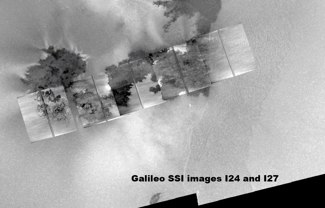
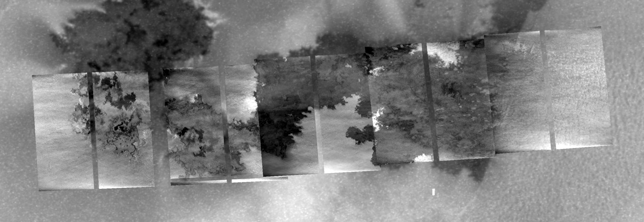
In Leone et al., the authors developed a map based on a two-frame green filter mosaic with a resolution of 150 meters per pixel from the Galileo I27 flyby of Io. The color version of this mosaic is shown above. Using mapping techniques developed over the last seven years with other Io mosaics, they observed eight material units in the Prometheus region: bright, white, and red diffuse material; layered bright plains material (concentrated in this region mostly in Prometheus Mensa, a comma-shaped, 250-meter tall ridged plateau bordering the Prometheus flow field to the east); white bright plains material; dark and undivided flow material; and dark Patera-floor material. Many of these materials relate to volcanic processes at Prometheus, such as the diffuse plume deposits and dark volcanic flows.
 One of the key goals of this mapping project was to determine the relationship between the observed material units and the volcanic activity at Prometheus. To help with this analysis, the authors took a look at high-resolution NIMS data from I24, which revealed several hotspots along the Prometheus flow field. In their paper, the authors compared this data with the same I27 regional scale mosaic they used for their map, however I've gone ahead and combined that NIMS and SSI data with the SSI mosaic acquired at the same time as the NIMS data and put them together into the animated gif at right. This animation allows for a better correlation between hotspots and dark flow units than the authors were able to find since they used SSI visible wavelength data that was acquired four months after the NIMS near-infrared data.
The authors determined that the source vent for the Prometheus flow field, rather than being located at Prometheus Patera, a volcanic depression located at the northwest end of the flow field, or along part of the western bounding scarp/fault of Prometheus Mensa, is instead located at a small lava lake estimated to be 60 meters wide at the hotspot labeled 1 in the animated gif above. Lava erupts at this vent, along with a small, sulfur-rich plume, and flows south and west via insulated lava tubes. Lava then breaks out from these lava tubes at several locations along the flow field. In the NIMS data, you can see these breakouts as small hotspots, while in SSI data they are visible as dark flow areas. Many of the breakouts are located at the western end of the flow field, akin to bird-foot delta structures in terrestrial river systems. Lava from these breakouts covers up older dark flows which had been covered by a dusting of sulfur dioxide frost. This frost-lava interaction is what fuels the nearly persistent volcanic plume.
Based on this scenario, Leone et al. was able to infer a possible sub-surface structure beneath Prometheus. Based on the persistent yet episodically variable thermal emission at Prometheus, they suggest the existence of two magma chambers beneath Prometheus Patera, one located 30 kilometers below the surface near the boundary between the lithosphere and the asthenosphere, and a shallow magma chamber at a depth of 9-10 kilometers (with a roof at around 2-3 kilometers). Magma ascends from the mantle to the primary reservoir via excess local pressure and the ascent of magmatic dikes. From their magma travels to the shallow reservoir via a dike that uses a local thrust fault part of the way. This thrust fault, which bounds the western edge of Prometheus Mensa, when active, would locally relieve the global compressive stresses felt in the lithosphere as the result of subsidence, helping magma ascend to the shallow reservoir. Now based on the previous picture of volcanism at Prometheus, magma would then continue to ascend to the surface using that thrust fault. However, with the source vent now thought to several kilometers to the west of the surface scarp, it is now thought that magma rises from the shallow reservoir via a side conduit that runs up southwest from that chamber.
Leone et al. 2009 presents a clearer picture of the volcanic history and eruption styles at Prometheus. The authors combined a regional-scale SSI mosaic of the lava flow field (though strangely didn't deal significantly with the higher resolution data by SSI) and high resolution NIMS data to produce a geologic map of the Prometheus region. This allowed them to generate a plausible scenario for the formation of this flow field (and the north-south trending flow field seen by Voyager in 1979) as well as the sub-surface structure beneath the volcano.
Link: Volcanic history, geologic analysis and map of the Prometheus Patera region on Io [dx.doi.org]


Thanks for the post, Jason!
ReplyDeleteThis comment has been removed by a blog administrator.
ReplyDelete