

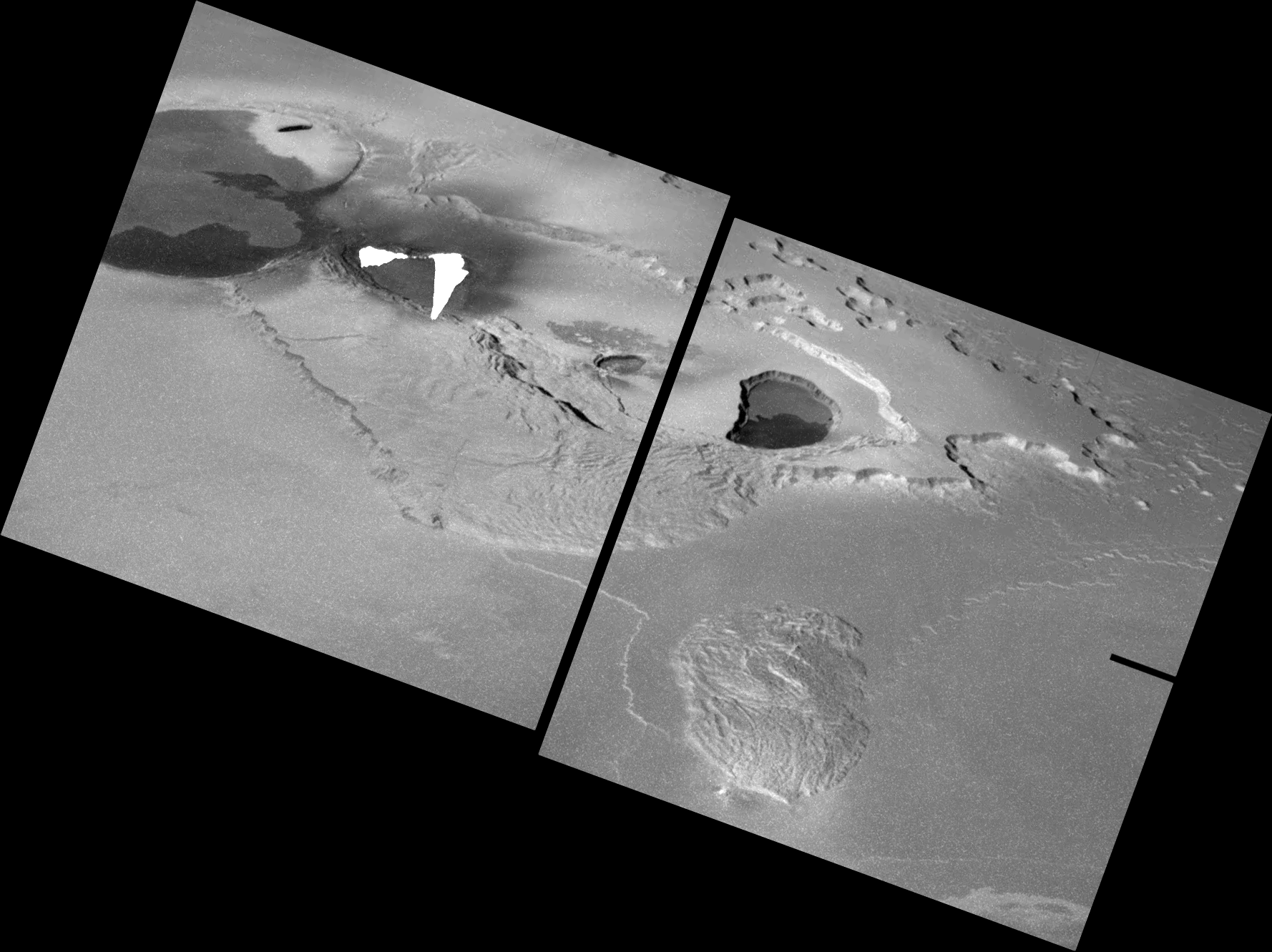
The difference between Zal Patera and last week's volcano of the week, Pillan Patera, is like night and day. Where Pillan experiences episodic, explosive volcanic eruptions that produce tremendous amounts of lava in a short span of time, eruptions at Zal were more frequent and consisted of smaller bursts of lava. These eruptions also cause smaller changes to the Ionian landscape, but Galileo's observations of the region show that this was not always the case as clear evidence for much larger lava flows are visible within Zal and to its south.

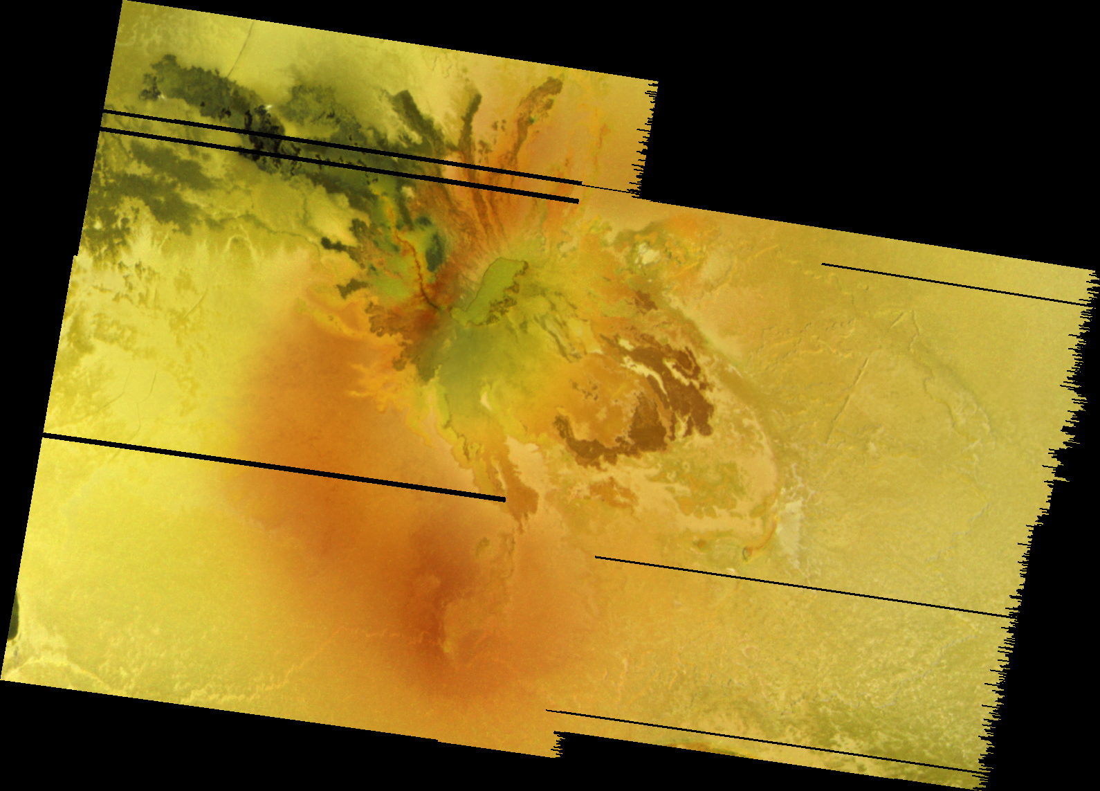
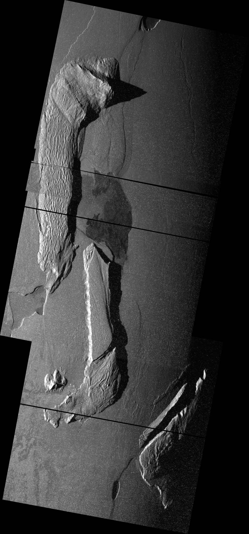
Zal Patera, shown in the center of the top frame in the mosaic above, is bounded by three mountains, all collectively part of Zal Montes. The northern component is 1.9-2.5 kilometers (6,200-8,200 feet) in height and consists of a large, heavily eroded plateau covering 15,600 square kilometers (6,000 square miles). The erosion is the result of two forces (since of course there is no atmosphere to support physical or chemical weathering): mass wasting and sapping. The first causes portions of the mountain to move down slope, either quickly through landslides or slowly through creep, forming rough landslide lobes at the base of the mountain. This can be most clearly seen on the southeastern edge of the plateau. The latter, sapping, occurs when sulfur dioxide is heated up and escapes from a mountain slope. On North Zal Montes, this creates the sawtooth pattern on its western and northern margins and the pits on top of the mountain, particularly on its southwestern end. South Zal Montes consists of a 225-kilometer (140-mile) long, 7.4-kilometer (24,300-foot) tall ridge that runs roughly north-south. The mountain has an asymmetric profile, like many of Io's uplifted crust blocks, with a steep sloped west margin and a shallower slope on its eastern side. On a whole, this mountain is more rugged than North Zal Montes due its more angled slopes, which encourages mass wasting. A smaller, third mountain is visible to the east of Zal Patera.

The high resolution images acquired by Galileo during the November 26, 1999 and February 22, 2000 encounters, the color data taken in July 1999, and near-infrared thermal data from Galileo's Near-infrared Mapping Spectrometer (NIMS) can be combined to create a picture of the style of volcanic activity that occurs at Zal. Zal was seen as an active volcano, based on its emission of near-infrared light, on several, intermittent occasions during the Galileo mission (June 1996, April-June 1997, September 1997, May 1998, and August-October 2001) and during the New Horizons flyby in February 2007. High-resolution thermal data from August and October 2001 provide a clue for the type of activity that occurs at Zal. In these observations, a hotspot was seen lying along the western margin of north Zal Montes (in October 2001, much of this hotspot was blocked from view by the plateau). Combined with the color data which shows a deep red lineament running from a small patera (called "Rustam Patera" in the Bunte et al. paper) along the western margin of south Zal Montes north to southwestern Zal Patera, a lineament which continues north as the western margin, and apparent source of lava flows at the volcano, of Zal Patera, a possible scenario emerges. The original source for lava at Zal Patera is to its south at "Rustam Patera". Lava emerging from this volcano flows northward via lava tubes that run along a fault that may have once broken up the Zal Montes complex. Skylight and the occasional breakout of lava along the 300-kilometer (186-mile) long system allow for the release of gas from the lava, forming deep red deposits along the fault, and fainter red deposits distally, including along the western slope of south Zal Montes. Galileo's SSI camera saw hotspots in eclipse along this fault/lava tube system on several occasions, particularly in May 1998. This system of tubes eventually ends along the western margin of Zal Patera where the lavas finally reach their nadir and flow out on to the surface, likely as part of an inflated flow field, as suggested by the NIMS data which suggest that active lava flows at Zal are less than a meter thick and certainly don't release tremendous amounts of energy like those at Pillan or Surt. Alternatively, the lava flows seen within Zal may form as a result of magma exploiting the fault that split up Zal Montes and formed the depression that became Zal Patera. This exploitation created "Rustam Patera" at the southern end of the fault, allowed sulfurous gases to escape along the southern half of it, and lava to flow out onto Io's surface along the fault's northern half. Future higher resolution observations will be required to distinguish between the two theories, but the predominance of thermal emission at one half of the fault or the other at any given time (rather than both at the same time) may lend support for the latter theory.

Next week, we will look at another of the volcanoes Galileo examined during the troubled I25 encounter, Emakong Patera. Until then, I hope you've enjoyed this look at this fascinating volcano.
References:
Schenk, P.; et al. (2001). "The Mountains of Io: Global and Geological Perspectives from Voyager and Galileo". Journal of Geophysical Research 106 (E12): 33201–33222.
Bunte, M. K.; et al. (2008). "Geologic mapping of the Zal region of Io". Icarus 197: 354–367.
Spencer, J. R.; et al. (2007). "Io Volcanism Seen by New Horizons: A Major Eruption of the Tvashtar Volcano". Science 318 (5848): 240–243.
Turtle, E. P.; et al. (2001). "Mountains on Io: High-resolution Galileo observations, initial interpretations, and formation models". Journal of Geophysical Research 106 (E12): 33175–33199.
Davies, A. G.; et al. (2005). "Post-solidification cooling and the ages of Io's lava flows". Icarus 176: 123–137.


No comments:
Post a Comment