Showing posts with label Dave Williams. Show all posts

Sunday, January 24, 2010

LPSC 2010: Analysis of the new Io Global Geologic Map

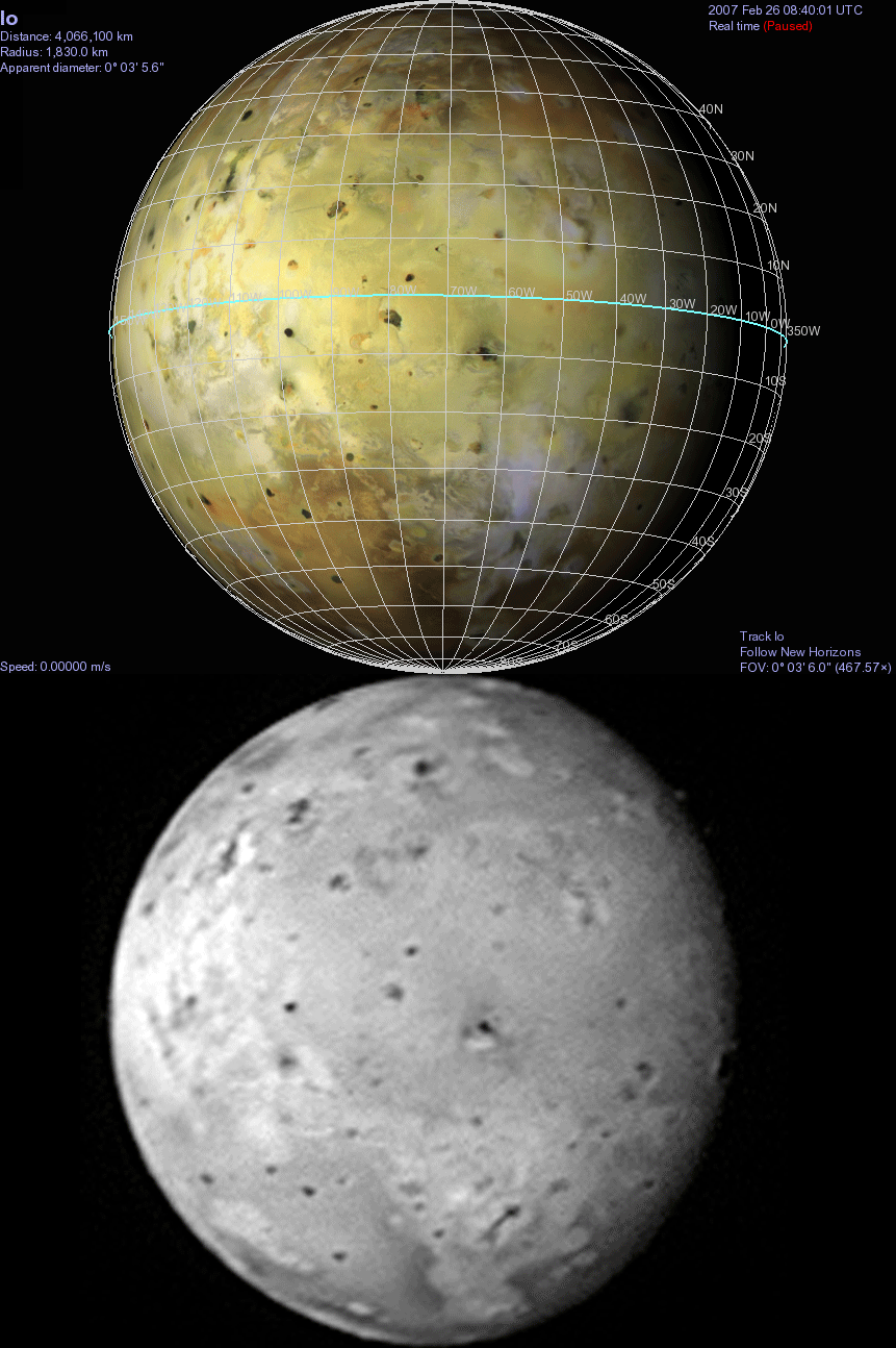
The next abstract we will take a look at is "Volcanism on Io: Results from Global Geologic Mapping" by Dave Williams, Laszlo Keszthelyi, Dave Crown, Paul Geissler, Paul Schenk, Jessica Yff, W.L. Jaeger. The authors completed a global geologic map of Io over the last few years in ArcGIS™ based on a basemap containing Voyager and Galileo created by the USGS.  Their map has gone through peer-review, but has not been published online as far as I know (I'd love to be proved wrong though).  Geomorphologic maps such as this global one can be used to determine the distribution of different terrain types across a planetary surface.  Progress on this project was reported earlier at the last few LPSCs, including 2008 and 2009, as well as other other conferences like EPSC.  This year's paper will be presented as a poster at the "Satellites and their Planets" session on Thursday, March 4.

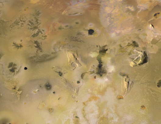
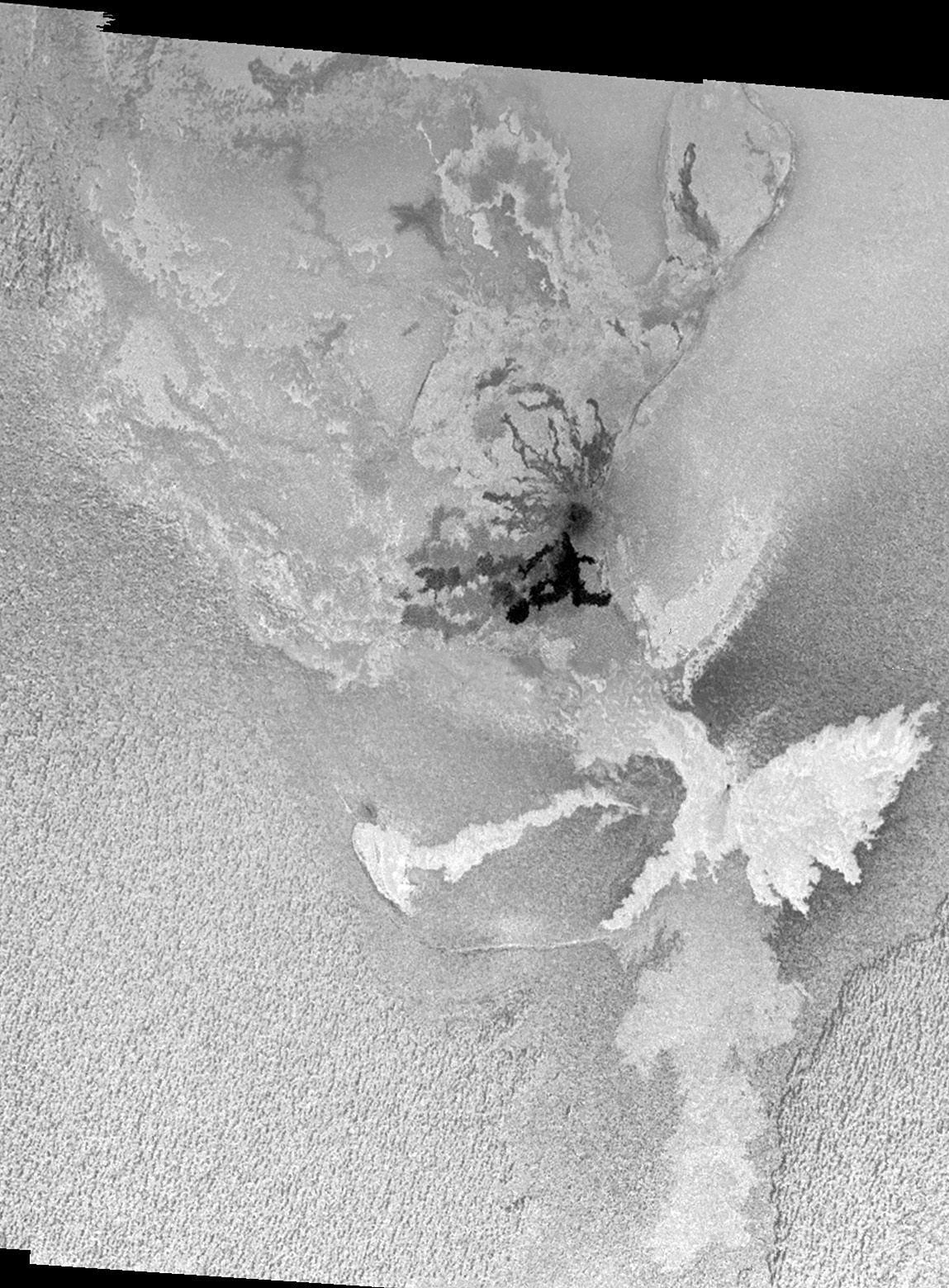
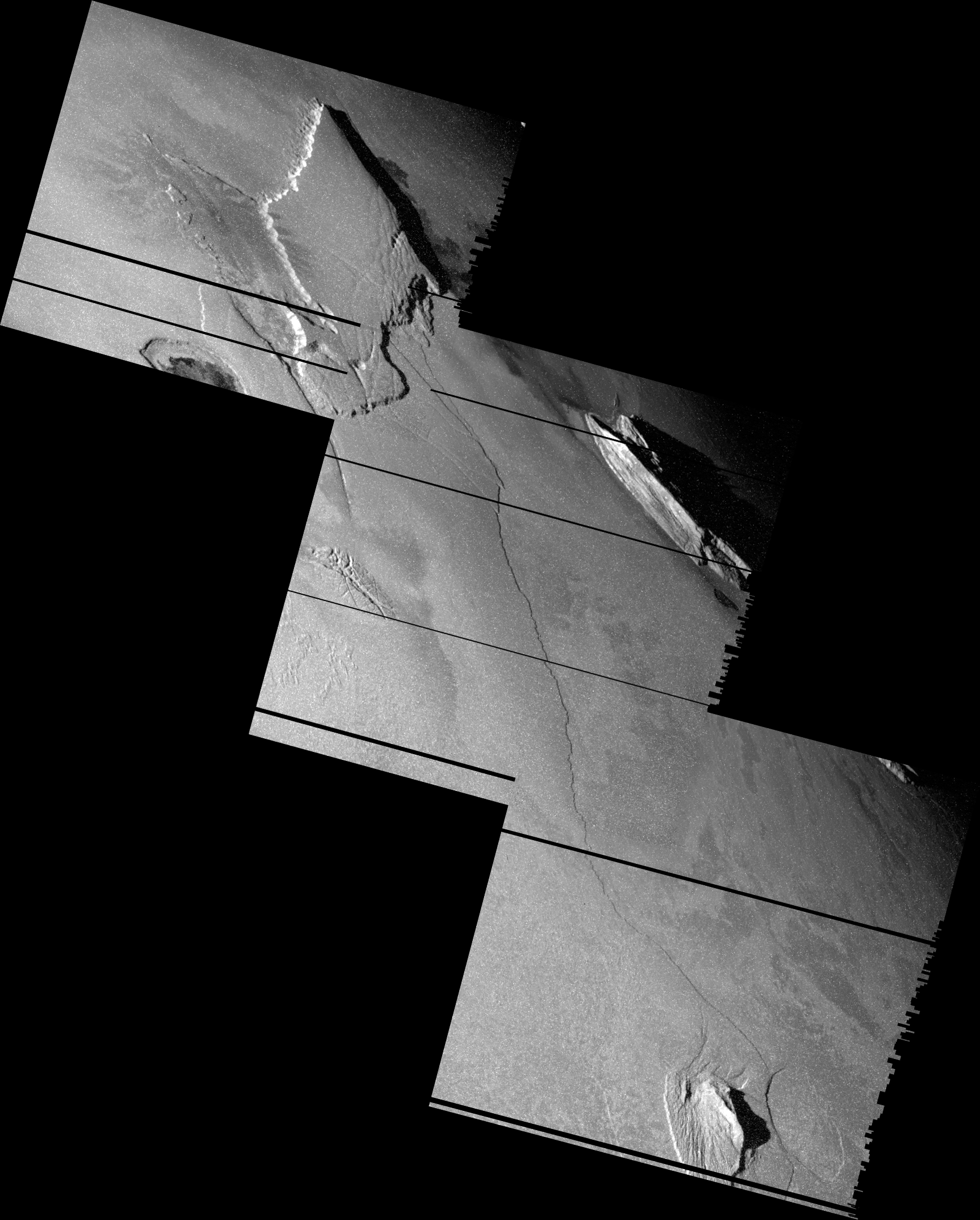
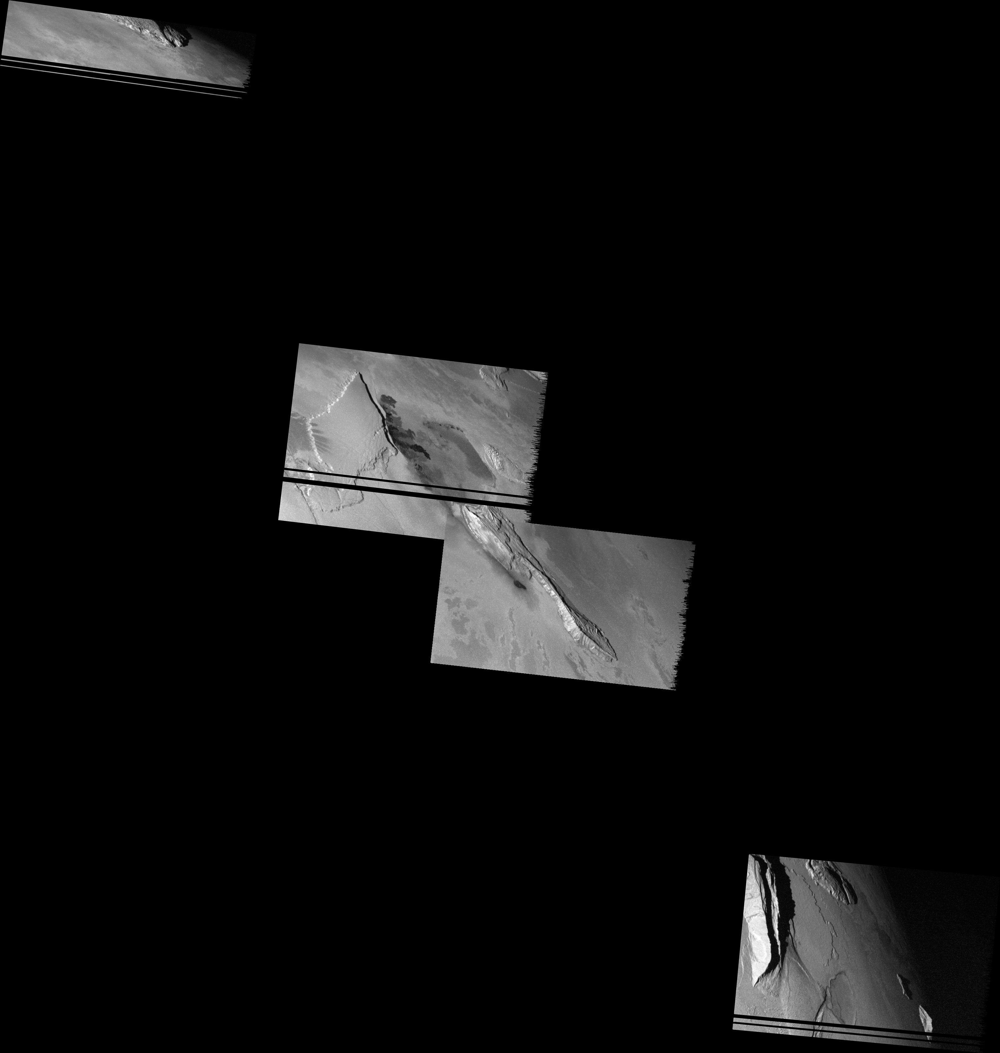
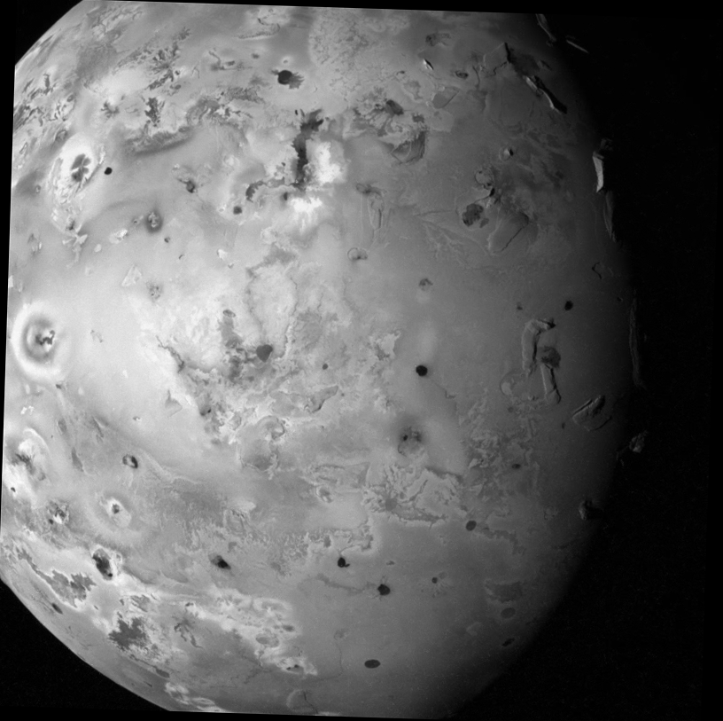
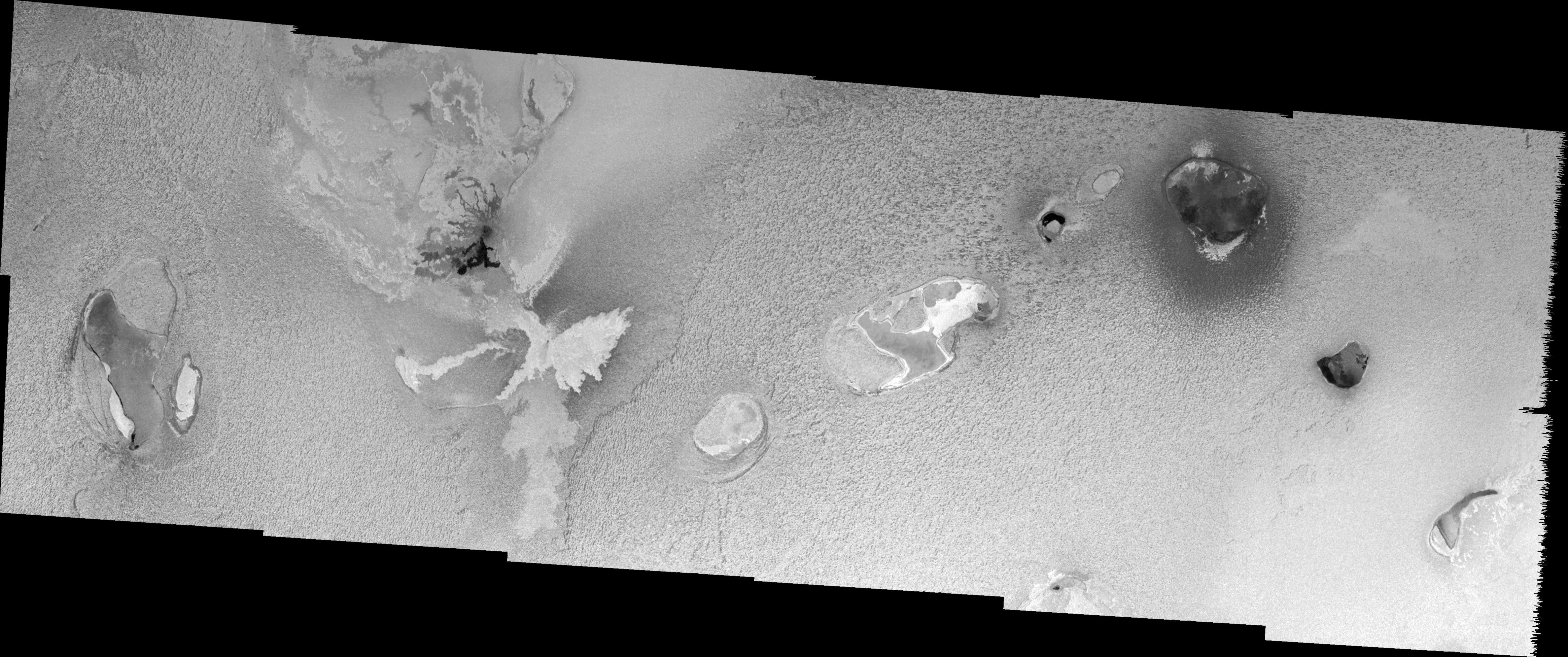
This year, the authors of the global geologic map will present statistical analyses of the units in the map, which include: plains, lava flows, paterae, mountains, and diffuse deposits.  This involves looking at where certain units and sub-units are most concentrated and how different sub-units are correlated.  As an example, they found that bright flow fields outnumber dark flow fields 3 to 2.  These are considered the youngest flows on Io, composed of sulfur compounds and silicate basalt respectively.  They note a concentration of bright flows at 45-75° N, 60-120° W, covered in the area shown at right.  Williams et al. argue that this region might be indicative of extensive sulfur volcanism here in the past.  An alternative explanation, particular given what happened at Thor (bottom center in the image at right, far right in the Thor link), would be that these flows are older silicate flows that have been coated with sulfur in falling from nearby plumes.  While these flows are old enough to be completely coated and turn a bright shade of yellow, they are not old enough to have been converted to red-brown sulfur (S4) through radiation damage.  So these flows stand out against the background plains, while at the equator, they might not have been as noticeable.  Thus the process of a lava flow aging and becoming indistinguishable from the background might take longer at the poles than at the equator.

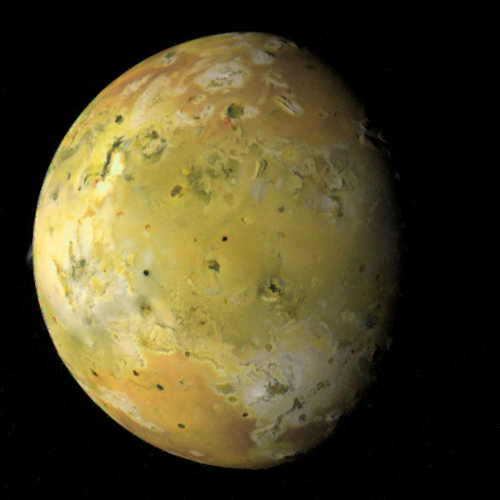
Comparing the distribution of Io thermal hotspots (indicative of volcanic activity) to terrain type, the authors found that 20.3% of hotspots are associated with dark flow fields, 9.3% with undivided flows (older mapped flows, like the ones at lower left in the color image above), 45.3% with dark patera floor material, 1.7% with bright flows, and 18.6% with other patera floor units.  This matches with intuition that recent active volcanism on Io is dominated by silicates.  One difficulty that would be interesting to see how they address are surface changes on Io over the course of the Voyager and Galileo missions, and between them.  For example, hotspots associated with undivided or bright flows may well come from fresh dark flows that formed after the images used in the basemap were taken, as would be the case for Thor.  Activity from Pillan in 1997 would also not be represented in the map since they don't appear in the basemap.

In additional analysis, the authors found that lineated mountains tend to be taller than other mountain that show signs of mass wasting.  This is as expected as mountains are thought to be uplifted crustal blocks that almost immediately begin to waste away.  When looking at diffuse deposits, they found that these materials are dominated by condensed gas deposits from volcanic plumes as opposed to pyroclastics, the latter normally associated with transient outburst-class eruptions, like Pillan or Thor, though some pyroclastic deposits seem to be more permanent around some volcanoes like Pele and Babbar.  Finally, they note that white plains, composed of sulfur dioxide ice fields, are mostly concentrated along the equator on the anti-Jupiter hemisphere in regions such as Colchis Regio, Bosphorus Regio, and Bulicame Regio.  They suggest that this region might be a colder region of Io's surface, possibly due to differences in magma sources, delivery mechanisms, and crustal thickness, but I wonder if runaway thermal segregation, the kind seen on Iapetus, might be a possibility.

In this abstract, Williams et al. once again take a look at the global geologic map the group has created over the last few years, attempting to use the map to determine correlations between different surface units and other Io data, such as mountain height and volcanic hotspots.  Hopefully, sometime in the next year, the map will be officially published, like the Ganymede map was last year.

Monday, December 14, 2009

Paper: Geomorphologic Mapping of Hi'iaka and Shamshu Regions

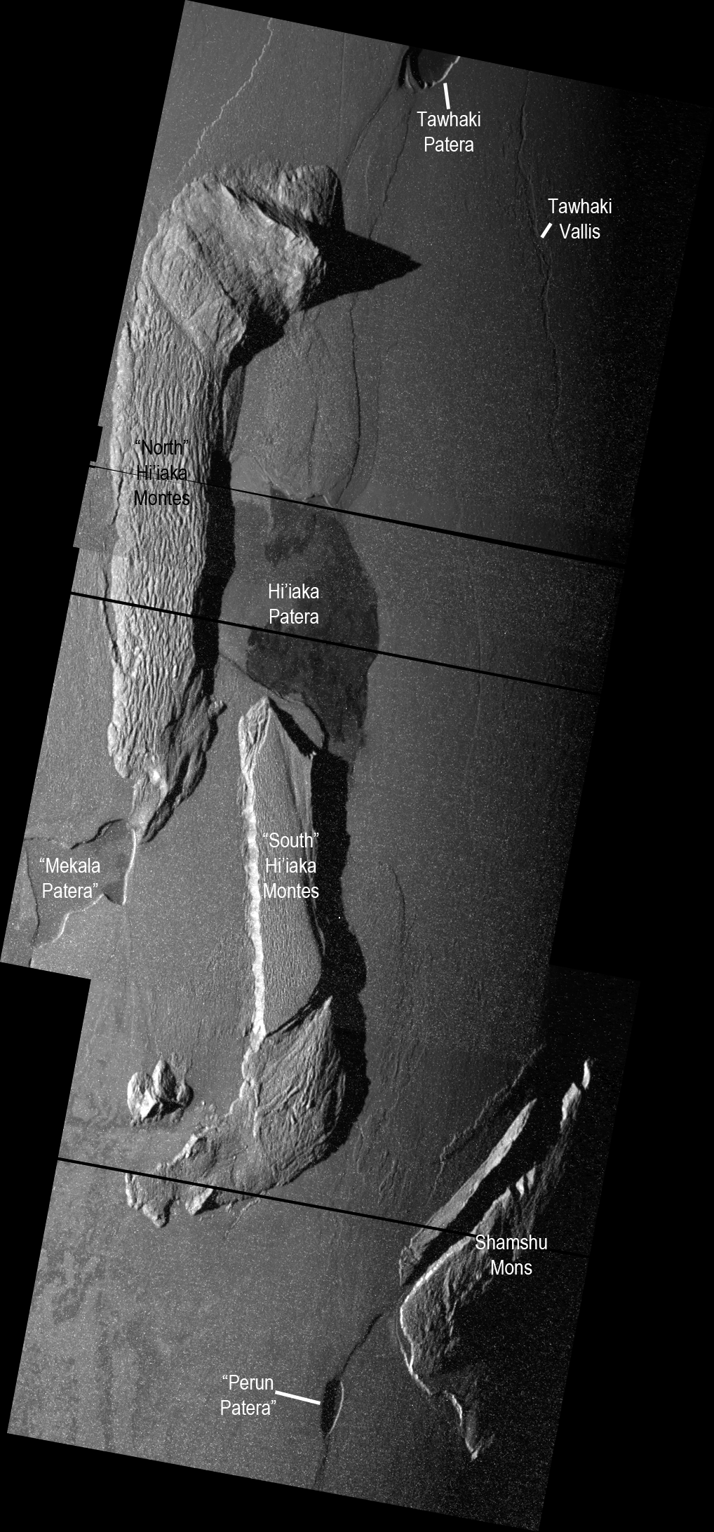
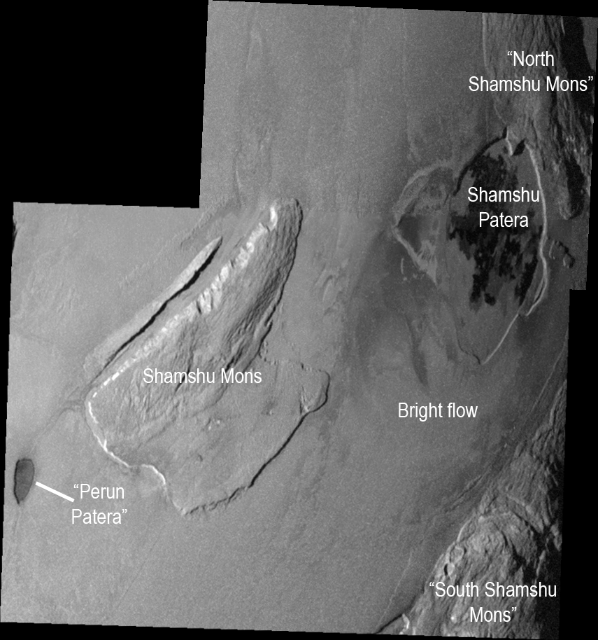
On Friday, a new paper was published in press in the journal Icarus titled, "Geologic mapping of the Hi’iaka and Shamshu regions of Io".  In press articles are those that have been reviewed and approved for publication, but have not yet been published in the print journal.  This paper, by Melissa Bunte, David Williams, Ronald Greeley, and Windy Jaeger.  This paper discusses the results of a geologic mapping project based on the 25ISTERM__01 mosaic of the Hi'iaka region and the 27ISSHMSHU01 mosaic of Shamshu region [I've also uploaded labeled versions of these two mosaics, Hi'iaka and Shamshu, to help people with this discussion].  These two regions are dominated by a patera with a floor partially covered in dark lava flows surrounded by several large mountains.  This paper is part of a series of geomorphologic mapping projects using medium-resolution Galileo mosaics of Io for their basis.  We previously covered papers discussing maps of Prometheus and Zal.  Other regions mapped by the ASU group include: Chaac-Camaxtli, Culann-Tohil, Zamama-Thor, and Amirani-Skythia-Gish Bar.  In March, I covered this group's LPSC abstract covering the mapping of Hi'iaka and Shamshu, so bare with me if I repeat some things from that post..

For this paper, the authors created two geomorphologic maps of the regions surrounding Hi'iaka and Shamshu Paterae, two volcanoes near Io's equator on the leading hemisphere.  These maps were based primarily on two SSI mosaics from Galileo's I25 and I27 encounters with Io in November 1999 and February 2000, respectively.  Color information and low phase brightness information was taken from the global color mosaic produced by the USGS.  Geomorphologic maps are a type of geologic maps where different surface units are identified and mapped so that relationships between these different units can be identified.

In the case of the Hi'iaka and Shamshu regions, four basic units types were identified: plains material, mountain/plateau materials, patera floor materials, and lava flow materials.  These units were also identified in the mapping of other regions on Io, though diffuse material, recent surface coatings that are derived from volcanic or sapping processing and identified in other mapped regions, was not identified in the Hi'iaka and Shamshu regions.  It should be noted though that diffuse materials are often transient; red diffuse material was observed in a faint partial ring of material surrounding Hi'iaka during Galileo's first orbit of Jupiter, suggesting the presence of a plume at Hi'iaka shortly before June 1996.

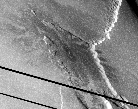
These four basic units were further sub-divided into different sub-units based on their albedo, color, surface texture, or structural contacts.  For example, mountain units are divided into lineated (ridged/grooved material, generally found at higher altitudes, bounded with plains by scarps), mottled (hummocky, often with lobed margins), undivided (intermediate in texture and altitude between the mottled and lineated types), and plateau (flat-lying terrain with smooth or hummocky textures) types.  Based on the spatial relationships between these units, the authors theorize that these types represent different stages of degradation on Io's mountains.  Lineated mountain units tend to be higher standing and have sharper unit contacts with the surrounding plains, suggesting that terrains of this unit have undergone the least amount of degradation.  The ridges and grooves, such as those seen above at north Hi'iaka Montes, are the result of down slope slumping of a mobile surface layer atop the mountain (see Jeff Moore's 2001 paper on slope degradation on Io).  Remember that mountains are thought to be tilted crustal blocks, the ridged and grooved top surface of the mountain is the result of the upper few kilometers of the mountains, which is a mix of basalt and sulfurous materials that was once part of the upper few kilometers of Io's flat plains.  Once that upper layer sloughs off, the unit transitions to the undivided or mottled types (though the mottled types are likely a mix of old mountain and the mass wasted materials surrounding the mountain).

A similar age progression in sub-units was also noted in patera floor and lava flow materials based on color and albedo (for dark flow/patera floor materials, darker equals younger).  The paper only mentions briefly the debate whether some bright or yellowish lava flows are primary or secondary sulfur flows, or silicate flows with chemical altered surfaces.  The authors (and I agree) that these flows are likely old silicate flows.  This supported less in this region but at Thor, where an outburst eruption generated lava flows that overlapped those of an older, yellowish flow.  Exceptions to this could include a bright white flow to the south of Shamshu Patera and the orange floors of "Mekala Patera" and western Hi'iaka Patera, which could be due to mobilized sulfur dioxide and sulfur, respectively.

As I mentioned in my post from March on the researchers' LPSC abstract on this subject, the authors examined the hypothesis that the three mountains that surround Hi'iaka Patera had at one point been part of a single structure that had split apart as a result of strike-slip and extensional faulting.  This fault would have also resulted in the creation of pull-apart basins that would become Hi'iaka Patera and orange-color patera to the lower left of north Hi'iaka Montes (named Mekala Patera in the paper).  The authors note that the freshest lava flows on the floor of Hi'iaka appear to emanate from the eastern and southern margins of the patera, a pattern consistent with this break-up scenario.  This model of regional-scale plate tectonics was also applied to the mountains in the Shamshu region (with Shamshu Patera being presented as a pull-apart basin) with less convincing results, but it does suggest a new line of investigation to see just how prevalent this style of plate tectonics is on Io with mountains forming, breaking apart, and shifting around across Io's surface.  How many other close groupings of mountains were the result of a single mountain being broken apart by strike-slip and extensional faulting?  I should note that several Ionain mountains have been observed with canyons running down the centers as a result of extensional faulting, like Ionian Mons (upper left), Mongibello Mons, and Danube Planum.

This paper summarizes the results of geomorphologic mapping of the Hi'iaka and Shamshu regions on Io based on regional-scale imaging by Galileo, finding units consistent with those found in other regional mosaics of the satellite.  The geologic history of these regions based on their mapping supports earlier research into this area by authors like Turtle et al. 2001 and Jaeger et al. 2001 that Hi'iaka Patera formed as the result of Hi'iaka Montes breaking apart by strike-slip and extensional faulting.  Magma then ascending to the surface using these same faults that bounded the pull-apart basin.  At this point, the volcanic activity at both Hi'iaka and Shamshu appear to be dominated by compound lava flows, unlike the lava lakes seen at Pele and Loki.  The mountains were then further degraded by gravitational mass wasting, SO2 sapping from ice layers within the mountain, and thermal erosion from nearby volcanoes.  Thermal erosion by flowing lava is thought to be responsible for Tawhaki Vallis, a channel observed to the right side of the image at top, as proposed by Schenk and Williams 2004.  Each of mountains in the region exhibit signs of degradation, from the ridges and grooves atop north Hi'iaka Montes and north Shamshu Montes, indicative of a slumping mobile surface layer, to hummocky-textured and lobe-edged landslide deposits, indicative of gravitationally- or sapping-induced mass wasting.

I think that leaves one more region to map, Tvashtar.

Link: Geologic mapping of the Hi’iaka and Shamshu regions of Io [dx.doi.org]

Friday, December 11, 2009

A Few New Io/Jupiter System Papers

Sorry for the hiatus there is posts over the last couple of months.  I've just been a bit busy with Cassini plus I wanted to take a bit of a break after posting so much in September and October.  I wanted to post a quick note letting you all know about three new Io/Jupiter System related papers currently in press in the journal Icarus.

The first is titled, "Geologic mapping of the Hi'iaka and Shamshu regions of Io" by Melissa Bunte, David Williams, Ronald Greeley, and Windy Jaeger.  This paper is the latest in a series that covers the geologic histories of some of the regions observed at high- and medium-resolution by Galileo during its flybys in the late 1990s and early 2000s.  Back in March, I covered the authors' LPSC abstract on this research so you can read up on that while I slowly get through this paper and post a summary over the weekend (hopefully, there is a major Titan flyby today whose data comes back Sunday morning).

The other Io paper is titled, "Multi-wavelength simulations of atmospheric radiation from Io with a 3-D spherical-shell backward Monte Carlo radiative transfer model" by Sergey Gratiy et al.  Yeah, that's going to take me a bit longer to get through.  Hopefully I can post something next week.

The final paper that caught my eye in Icarus is titled, "Global geological mapping of Ganymede" by G. Wesley Patterson et al.  This paper discusses the completed Ganymede global geologic map and presents research on the observed geologic units on that satellite.  Again, I've only flipped through the article, and maybe later this month I can write up something about it.

Sunday, September 20, 2009

Io Presentations at EPSC

While normally I remember to cover the big four conferences for planetary science each year (LPSC in March, AGU in May and December, and DPS in the fall), I often forget about the main European planetary science conference, the European Planetary Science Congress or EPSC.  Io science tends to be dominated by American institutions like the University of Arizona, the Jet Propulsion Laboratory, and Arizona State University, so a European conference would be expected to have less Io coverage than those held in the US.  However, this year, three talks and one poster were presented last week in Potsdam, Germany.  Let's take a look at the abstract for these four presentations:
  • The last talk in the Satellite Atmospheres session this past Thursday, September 17, was titled, "First detection of Io's atmosphere at 4.0 micron" and was presented by Emmanuel Lellouch et al. Lellouch and his colleagues observed Io in the near-infrared using the CRIRES spectrometer at the Very Large Telescope in Chile in July 2008.  These measurements allowed the authors to observe an absorption band of sulfur dioxide gas at 4.0 μm.  With the adaptive optics system at VLT, they were also able to spatial resolve variations in the absorption band, looking for differences in atmospheric column density between the polar region and the equator.  Lellouch et al. believe that these observation open up a new avenue for monitoring Io's dynamic atmosphere.
  • The Satellite Surfaces and Interiors oral session this past Wednesday, September 16 hosted two Io talks.  The first was titled, "Volcanism on Io: New Insights from Global Geologic Mapping" and was presented by David Williams et al.  This talk and abstract provide an update to the Io geologic mapping project, a subject Williams presented at this year's Lunar and Planetary Sciences Conference, which I discussed in greater depth earlier this year.  This geologic map displays the distribution of various morphologic and color units across Io's surface.  Using software such as ArcGIS™ will allow researchers to use the map to conduct various lines of research, including comparing the areas of various mountain units with their heights, looking at the areal extent of the various plains units, and seeing how ongoing volcanism change these areal extent of the different lava flow units.  The authors also plan to assess the distribution of different flow units to assess regional variations in the style of volcanism (sulfur versus silicate volcanism, for example) and compare these units to observed volcanic hotspots to look for correlations between eruption style and unit types.  The Io Geologic map was completed in February 2009 and has been submitted to the USGS for peer review.  A similar global geologic map of Ganymede was also presented at the conference, which has garnered some press coverage (but not Io's, bah I say, BAH!) .
  • The other Io talk at the Surfaces session was titled, "Continued Observations of Io's Volcanic Activity" and was presented by Imke de Pater et al.  In this abstract, de Pater briefly presents new results from observations of Io in the near-infrared using the adaptive optics system at Keck in Hawaii.  These results include new observations of volcanic hot spots on Io as well as the distribution of sulfur dioxide frost across Io's surface.  While the abstract left out specifics, the authors spent more time advocating for additional telescopic observations of Io.  Regular observation runs were conducted during the Galileo mission and the New Horizons flyby in 2007, but outside of that flyby, Io monitoring has been sparse the last few years.  Regular monitoring is important for understanding Io's heat flow and its active volcanism. de Pater et al. also advocate for the inclusion of narrow angle cameras on board Jupiter-bound missions, particularly EJSM, to provide for monitoring of Io and other satellites in the system.
  • Finally, Ashley Davies, Laszlo Keszthelyi, and Alfred McEwen presented a poster titled, "Determining Io Lava Eruption Temperature: Strategies for a New Mission to the Solar System's Most Dynamic Satellite."  These authors presented a similar poster at LPSC earlier this year, which was discussed here a bit more extensively.  This abstract discusses how the desire to measure the temperature of Ionian lava using near-infrared camera observations of lava fountains and skylights (holes in the roofs of lava tubes).  The authors explain that near-simultaneous, high-resolution color imaging during Io flybys by either a dedicated Io mission (such as the Io Volcano Observer) or by another Jupiter system mission (like EJSM) would be necessary for determining these lava temperatures without the issues from short-term variability (on the order of a few seconds) of lava fountains.  The authors also state that these observations would need to be preformed over Io's night-side to avoid contamination from sunlight.
With EPSC now passed and DPS abstracts online for that meeting in two weeks, we now have to wait for AGU abstract to be posted online.  The Fall AGU meeting is scheduled for December 14-18 and abstracts for this meeting are usually posted online in mid- to late-October.  At last year's fall meeting, five Io-related talks and posters were presented, so we will see what this year brings.

Link: European Planetary Science Congress [meetings.copernicus.org]

Saturday, September 19, 2009

Final Version of the Io Decadal Survey White Paper Posted

The final draft of the Io Decadal Survey White Paper has been posted online.  The white paper consists of two sections: the first summarizes the state of Io science, the justification for NASA sending additional missions, and the outstanding questions that should be addressed by future exploration of the satellite; the second discusses an exploration strategy for addressing these remaining questions.  The other submitted white papers can be found on the National Academies website; Van Kane has a good summary on his blog of these other papers.  I previously posted a note about the recommendations for future missions to Io based on an earlier draft of the white paper.

Let's take a look at the two Io white papers.  The first, Justification and Science Objectives, takes a look at the reasons why other planetary scientists should be interested in exploring Io, the outstanding questions left by the exploration of Io by Galileo and New Horizons, and the science objectives that a future Io mission or series of Io missions should attempt to accomplish.  In addition to the fact that Io is just plain awesome and everyone knows it ("Finally, as one of the most spectacular places in the Solar System, Io has unique public
appeal, and Io exploration offers many opportunities to attract and engage public interest in
planetary science."), the authors point out that studying Io provides opportunities to understand processes that are important to examine in general, including: satellite-magnetosphere interactions; the mechanics of tidal heating, an important process for Io as well as Europa, Ganymede, and Enceladus, as well as for extra-solar planetary systems; volcanism, particularly that found on the Moon and Archean Eon Earth; and the dynamics of thin atmospheres, particularly those which are strongly driven by surface temperature and vapor pressure. The authors also identified eight science objectives that an Io exploration campaign would attempt to accomplish (the sub-headings are my own notes):
  1. Determine the magnitude, spatial distribution, temporal variability, and dissipation
    mechanisms of Io’s tidal heating. (We would like to add “and implications for the coupled
    orbital-thermal evolution of Io and Europa.”)
    1. The latter goal can be helped by the examination of Europa to be performed by EJSM.
  2. Determine Io’s interior structure, e.g., whether it has a magma ocean.
  3. Determine whether Io has a magnetic field.
    1. This fits into the previous objective.  As explained later in Part 1, understanding the state of the core, its Fe/S ratio, and its size would help us understand the result obtained by Galileo that suggests that Io does not have a magnetic field.  Resolving the conundrum of why Io can be so active and not have one might help us better understand how planetary magnetosphere are created.
  4. Understand the eruption mechanisms for Io’s lavas and plumes and their implications for
    volcanic processes on Earth, especially early in Earth’s history when its heat flow was
    similar to Io’s, and elsewhere in the solar system.
    1. Two good places to provide comparative studies would be the Moon and Mercury.  While these two worlds are dead as a doornail now (deader actually), earlier in their histories, they experienced volcanic eruptions similar to those we see on Io now, particularly flood basalt eruptions and pyroclastic flows.
  5. Investigate the processes that form Io’s mountains and the implications for tectonics under
    high-heat-flow conditions that may have existed early in the history of other planets.
    1. In addition to the high-resolution observations to be obtained by Io-centric missions discussed in Part 2 of the white paper, additional information could be gained for this goal from the Ice-Penetrating Radar (IPR) on board the Jupiter Europa Orbiter during its two of its close flybys.
  6. Understand Io’s surface chemistry, including volatiles and silicates, and derive magma
    compositions (and ranges thereof), crustal and mantle compositions and implications for the
    extent of differentiation, and contributions to the atmosphere, magnetosphere, and torus.
  7. Understand the composition, structure, and thermal structure of Io’s atmosphere and
    ionosphere, the dominant mechanisms of mass loss, and the connection to Io’s volcanism.
  8. Investigate the neutral and plasma densities and energy flows in the Io plasma torus, plus their
    variations over time, and characterize the ionic radiation belts in the vicinity of Io and their
    influence on the surface.
The second part of the Io white paper, Recommendation for Missions, was more extensively discussed in my last post on this subject.  To answer Ted's comment for that post, where he suggested that IVO, a proposed Discovery-class Io mission, would be the most likely to fly, keep in mind that what is discussed in Part 2 is an exploration program, akin to what is currently going on for Mars.  For Io, this program would start with either a New Frontiers- or Discovery-class mission that would orbit Jupiter and flyby Io on several occasions.  Such a mission could be flown in the 2013-2023 decade covered by this survey.  Following this "Io Observer" mission, the next decade, 2023-2033, could see a follow-on mission that would orbit Io, providing detailed global maps using UV, visible, and near-infrared imagers and a laser altimeter, as well as measuring Io's gravity and possible magnetic fields, and deploy one or more in situ components, such as penetrators, landers, or rovers.  One important task for these in situ missions would be to measure seismic activity using seismometers.  Enough activity should be detected over a period as short as a day to provide a more detailed model of Io's interior structure.  Finally, the authors support telescopic observations of Io from Earth or from space-based platforms, including a UV telescope that would replace the capabilities that will be lost once Hubble is de-orbited and additional ground-based telescopes with adaptive optics capabilities, which would help ease scheduling pressures at telescopes such as Keck II.  These observations would allow for monitoring time-variable phenomenon at Io such as satellite-magnetosphere interactions, Io's atmosphere, and its volcanic activity.

Additional white papers can be found at the National Academies website as well as summaries at Van Kane's blog.  These white papers will be used as input into the upcoming Decadal Survey report, which will outline the direction planetary science should go within NASA over the next decade.  How much will be possible is up in the air as the planetary budget is projected to remain pretty flat over the next decade.  For Io, since the recommendations call for a fairly modest program over the next decade (one mission in either the New Frontiers or Discovery programs) with the major mission to be started in the decade following, it isn't impossible that such a program could fly.  What remains to be seen is how much NASA and the community will take to heart the first suggestion made by the authors of the Io white paper:
We recommend that NASA pursue a balanced solar system exploration program between life-focused and physical-science focused missions.
Link: Future Io Exploration for 2013-2022 and Beyond, Part 1: Justification and Science Objectives and Future Io Exploration for 2013-2022 and Beyond, Part 2: Recommendations for Missions [www8.nationalacademies.org]

Saturday, February 7, 2009

LPSC 2009: Insights from Global Geologic Mapping of Io

The other mapping poster that will be presented at LPSC this year is by Dave William et al. and is titled, "Volcanism on Io: Insights from Global Geologic Mapping". This poster will present the status of the global geologic map project as well as present examples of results derived from the map. The authors' LPSC 2008 update was discussed on this blog last year.

The geologic mapping group finished the global map last year in ArcGIS. They are now working on a database to incorporate information about surface changes observed by Galileo, Voyager, and New Horizons.

This abstract two examples of statistical analyses that have been performed on the geologic map. The first compares the height and area of various mountain units. The authors find that lineated mountains tend to be taller than mottled mountains. This supports the hypothesis that mottled mountains are more degraded, and thus older, version of the younger lineated mountain unit. However, based on the plot of mountain height-vs-area, they may be dealing with statistics of small numbers as only 4 mottled moutains are plotted. The layered plains unit, thought to be an even more degraded mountain unit, has a similar area distribution as the other mountains units, but tend to be restricted to under six kilometers in height, further supporting formation from degradation.

The rest of the abstract is spent looking at the temporal correlation of mapped units. Williams et al. propose that mountain units are the oldest geologic unit, forming over a period from several millenia ago to perhaps several million years ago. This is based on the observed pattern of degradation at the various mountains mapped on Io (lineated mountains -> undivided mountains -> mottled mountains -> layered plains) and the superposition of other units on mountains such as diffuse volcanic deposits and paterae (seen at some mountains to be "eating" into them, such as at Tohil Mons and Gish Bar Mons). Volcanic units have formed much more recently, with diffuse deposits and dark and bright flows (both on the plains and in paterae) forming during the period of spacecraft observation. Plains units fill in the gap between volcanic units and mountain units, the result of the buildup volcanic deposits and mountain mass wasting that have since become homogenized and can not be split into different units (like undivided flows).

Again, another interesting paper, but I am curious as to when or if the geologic map will be available online as a downloadable product like some of the older Galilean satellites maps or the Venus geologic maps.

Link: Volcanism on Io: Insights from Global Geologic Mapping [www.lpi.usra.edu]

Wednesday, May 14, 2008

Geologic Mapping of the Zal region of Io

There is a new article in press in the journal Icarus titled, "Geologic Mapping of the Zal region of Io," by Melissa Bunte, David Williams, and Ron Greeley. A summary of their results was presented in March at the Lunar and Planetary Sciences Conference and was reported on here. Now the full paper is available on the Icarus website (subscription required to view paper). This paper is based on imagery acquired during the I25 and I27 Galileo encounters with Io.

Like many of the regions mapped by the ASU previously, such as near Camaxtli Patera, Tohil Mons, Amirani, and Thor, the authors mapped 5 basic units in the region: mountains/plateaus, smooth/layered plains, patera floor material, flow material, and diffuse materials. The flow features in this area appear to be generated from a small patera lying near the western margin of South Zal Montes (they propose the name "Rustam Patera" for this volcano) or from a fissure that runs north from "Rustam" along the western margin of South Zal Montes and the eastern margin of North Zal Montes. The flows include bright flows (possibly of sulfurous composition) radiating out from "Rustam" and dark flows which flow east across part of Zal Patera from the northern part of the fissure. Additional flow features are also seen within Zal Patera, but these appear to be older in age based on their brighter appearance.

One interesting hypothesis made in this paper is that the various components of Zal Montes, which surround Zal Patera to the west, east, and south, were originally part of a single structure. This feature then broke-up due to strike-slip then extensional faulting, opening up Zal Patera. Similar plate tectonics-in-miniature is theorized for formation of Hi'iaka Patera. The paper goes on to describe the degradational processes that have occurred at the mountains in the region.

One feature I wished the paper expounded on further is a small volcano west of North Zal Montes, which they suggest the name "At'am Patera" for. What makes the volcano interesting is that it appears to be one of a very rare breed of explosive Ionian volcano. "At'am" erupted between late-June and mid-September 1997, producing a white, Sulfur dioxide-rich plume deposit and a dark-green pyroclastic deposit with a digitate margin. Some of both materials was deposited on North Zal Montes. The digitate appearance is due to the interaction between the pyroclastic flow and the arcuate margin of the western part of North Zal Montes. This morphology may provide clues on how these pyroclastic deposits are formed on Io. Oddly, for an Ionian eruption, no lava flows or thermal emission were observed at this volcano. Also, the central vent is among the smallest paterae found on Io. It is possible that the 1997 eruption could have been the result of an intrusive event, where magma ascends from a deeper chamber, but fails to reach the surface. However, volatiles and other materials, being more buoyant, do make it to the surface.

The paper does touch a bit on the plume seen at Zal last year by New Horizons. This plume is centered on Zal Patera (unlike the plume deposit seen by Galileo starting in Sept. 1997 which surrounds "At'am Patera"). Zal Patera is also the site of fresh surface changes, which include a new dark plume deposit and fresh dark lava flows.

Link: Geologic Mapping of the Zal region of Io [dx.doi.org] (subscription required to view paper)

Sunday, March 9, 2008

LPSC 2008: Global Geologic Mapping of Io

The final Io-related poster that will be presented during Tuesday's poster session at the Lunar and Planetary Sciences Conference is titled "Global Geologic Mapping of Io: Preliminary Results" by Williams et al.

This is an update on the author's three-year global mapping project. They are nearly finished with their work and will present a preliminary version of their global geologic map at LPSC. They hope to have a completed version submitted to the USGS by June.

Global geologic maps help scientists assess the relationships between different types of terrains as well as calculate what percentage of the surface is covered by a particular unit. For example, one project the author's plan on using the map for is to determine whether NIMS hotspots are correlated with dark lava flows, while PPR hotspots are correlated with bright lava flows. The Near-Infrared Mapping Spectrometer (NIMS) was sensitive to shorter, infrared wavelengths (1-5 microns) and thus sensed thermal emission from hotspots with temperatures greater than 200 K, often warmer than that when NIMS observed the day-side of Io. The Photopolarimeter-Radiometer (PPR) was sensitive to thermal infrared wavelengths and thus looked at cooler hotspots down to those just above the background temperature. At several locations, these hotspots were not correlated, suggesting that some PPR hotspots were related to sulfur volcanism, while NIMS hotspots were related to silicate volcanism. The authors plan to investigate that possibility.

Based on their geologic map, the authors determined that the most common surface type on Io is the plains unit, covering 66% of the surface. The next most common is the lava flow unit, covering nearly 28% of the surface.

By the way, if you want to read all of my posts covering the Io abstracts for this year's LPSC conference, you can check out the special page just for them. Still got one more to go.

Link: Global Geologic Mapping of Io: Preliminary Results [www.lpi.usra.edu]

Saturday, March 8, 2008

LPSC 2008: An Assessment of Near-Surface Conditions Conducive to Ionian Sulfur Flows

Arizona State University's Ramses Ramirez, Dave Williams, and Ron Greeley have a poster at next week's Lunar and Planetary Sciences Conference titled, "An Assessment of Near-Surface Conditions Conducive to Ionian Sulfur Flows." In this poster, the authors look at whether the bright flows seen at Sobo Fluctus (left) could have been generated secondary sulfur flows heated by a near-surface magma chamber.

In the model used by Ramirez et al., they consider a near-surface magma chamber whose heat is conducted by the surrounding silicate-sulfur country rock to the surface. They then estimated the amount of sulfur that would be melted by such a magma body and compared that to the size of the flows seen at Sobo Fluctus.

The authors determined that the amount of sulfur melted by a near-surface magma body was insufficient to explain the bright flows seen at Sobo. They suggest that the flows are instead primary sulfur flows, erupted from a vent with lava originating in a sulfur magma chamber below the surface.

Interesting work that further suggests the possibility of sulfur flows on Io, at least at some select locations. Many of these flows seem to occur outside of paterae. One possibility is that such activity is usually part of the first stages of paterae formation.

To create the above image of Sobo Fluctus, I reprocessed the entire CAMAXT01 mosaic from I27, which covers the region between Chaac Patera and Camaxtli Patera. Hope you all enjoy!

Link: An Assessment of Near-Surface Conditions Conducive to Ionian Sulfur Flows [www.lpi.usra.edu]

Thursday, February 28, 2008

LPSC 2008: Geologic Mapping of the Zal Region of Io

The Lunar and Planetary Sciences Conference is coming up in a couple weeks. I unfortunately will not be attending but the abstracts for the conference, which are almost mini-papers in length, have been online for a few weeks now. Nearly all the Io-related abstracts are for posters to be presented on the evening of Tuesday, March 11. In this post, and in blogs to be posted over the next week or so, I will cover one of the abstracts for this conference.

The first abstract I'm going to discuss is "Geologic Mapping of the Zal Region of Io" by Melissa Bunte, David Williams, and Ron Greeley. This abstract covers work done as a part of series of geologic mapping work performed by the Planetary Geology group at Arizona State University on the mosaics Galileo acquired of Io during its seven encounters. This time they cover the area around Zal Patera. This volcano on Io's northern Leading hemisphere is bounded to the west and south by the two-part Zal Montes.

Like most places the group has mapped, they found 5 basic terrain types: plains, mountains, patera floor materials, flow materials, and diffuse materials. Their mapping allowed the authors to determine the age relationships between the different flow units within Zal Patera based on the brightness of the flows. Basically, as a flow ages, it cools (obviously) and as it cools, more volatiles can condense on it. Color-wise, the progression at this latitude is (generally now) from black, to green (when you got your sulfur mixing with your iron), to yellow (thanks to S8), and then to red-brown when radiation starts to work on the sulfur and break it down (anyone know how long that roughly takes, by the way?). The group also mapped some very extensive, old flows that they attribute to Rustam Patera, the proposed name for an active volcano on the western margin of South Zal Montes.

Following the work they have done previously in the Amirani and Camaxtli regions on Io, they will like publish this work sometime in the next year or so. Certainly will be a paper to look for. I would be interested in how they handle the connection between Rustam Patera and the lava channel that runs north from it up through to what they identify as a fissure along the western margin of Zal Patera. Another interesting feature in this region (or actually just off the western edge of their mapped segment) is a small, explosive eruption from the summer of 1997 that produced a small dark pyroclastic deposit that partly overlaps onto the western margin of the North Zal Montes plateau, which is identified as a flow (?) in the map included in the abstract, and a bright ring around that pyroclastic deposit. Strangely enough, no obvious effusive materials from that eruption.

The ASU group also has another poster at the conference where they present the work they have done so far on producing a global geologic map. I will discuss that abstract in a later post.

Link: Geologic Mapping of the Zal Region of Io [www.lpi.usra.edu][pdf file]