Showing posts with label Prometheus. Show all posts

Tuesday, October 20, 2009

Paper: Geologic Mapping of the volcano Prometheus

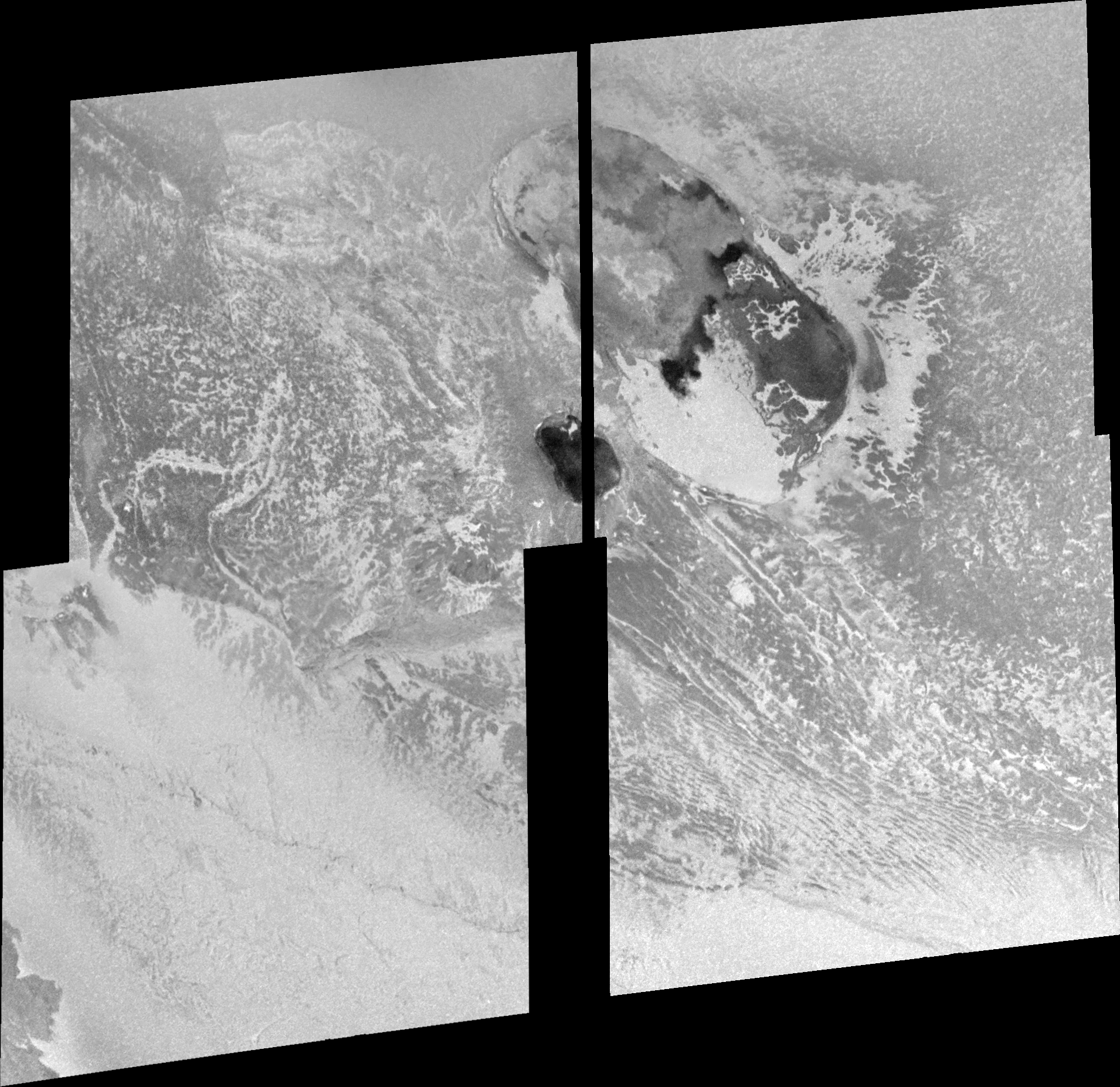
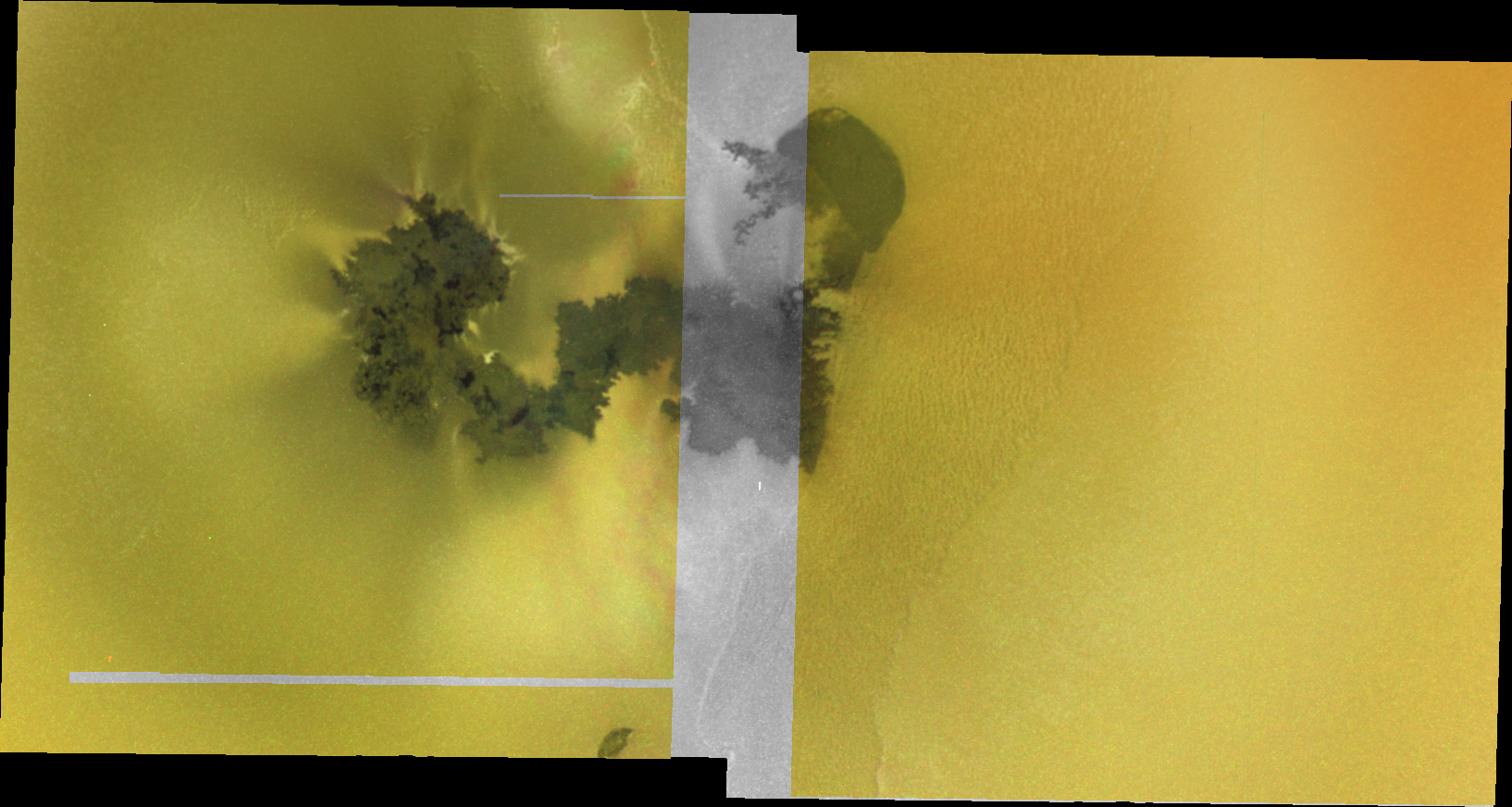
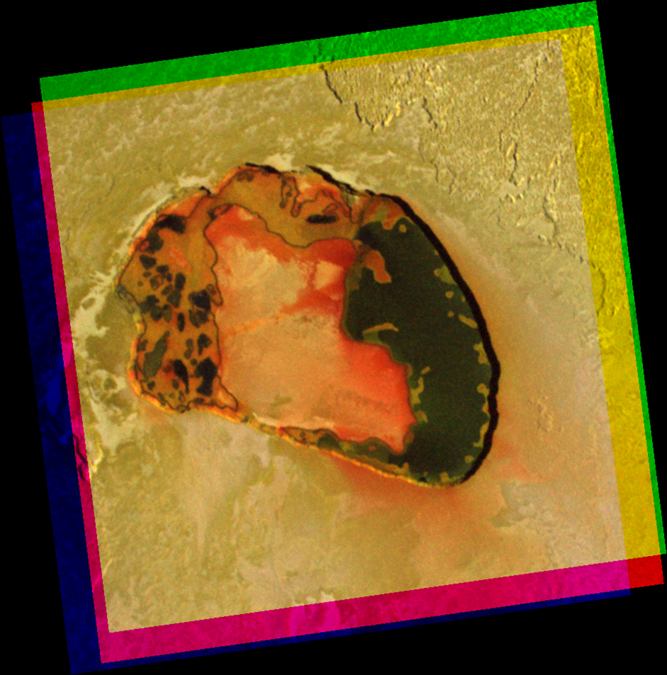
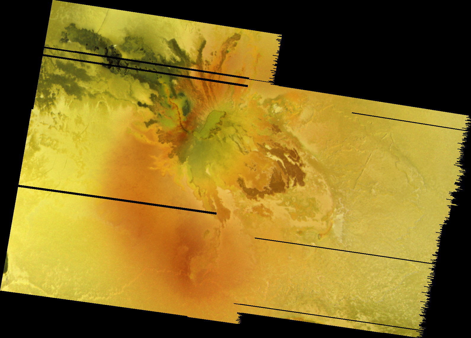
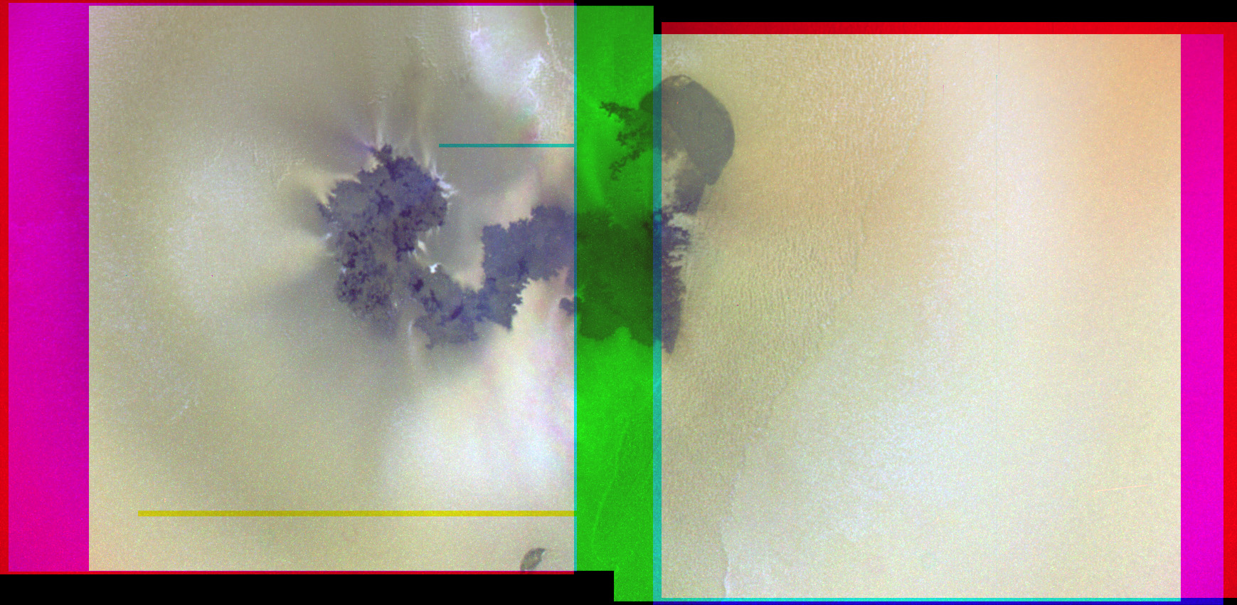
A new, Io-related paper was published in the October 30 issue Journal of Volcanology and Geothermal Research titled, "Volcanic history, geologic analysis and map of the Prometheus Patera region on Io. The authors of this paper are Giovanni Leone, Ashley Davies, Lionel Wilson, David Williams, Laszlo Keszthelyi, Windy Jaeger, and Elizabeth Turtle.  In this paper, the authors present a geologic map of the Prometheus lava flow field and surrounding terrain based on the Galileo's Solid State Imager (SSI) mosaic shown at right.  The authors then combined this map with analysis of high-resolution data from Galileo's Near-infrared Mapping Spectrometer (NIMS) to determine the relationship between the albedo, topographic, and thermal features observed in SSI and NIMS data and geologic features at Prometheus.  From this analysis, the authors can then infer the sub-surface structure beneath Prometheus.  On this blog we have covered other recent geologic maps developed from Galileo regional-scale mosaics of Io, including the area near Zal Patera and Hi'iaka and Shamshu Paterae, as well as a few posts covering the global geologic map currently in production.

In Leone et al., the authors developed a map based on a two-frame green filter mosaic with a resolution of 150 meters per pixel from the Galileo I27 flyby of Io.  The color version of this mosaic is shown above.  Using mapping techniques developed over the last seven years with other Io mosaics, they observed eight material units in the Prometheus region: bright, white, and red diffuse material; layered bright plains material (concentrated in this region mostly in Prometheus Mensa, a comma-shaped, 250-meter tall ridged plateau bordering the Prometheus flow field to the east); white bright plains material; dark and undivided flow material; and dark Patera-floor material.  Many of these materials relate to volcanic processes at Prometheus, such as the diffuse plume deposits and dark volcanic flows.
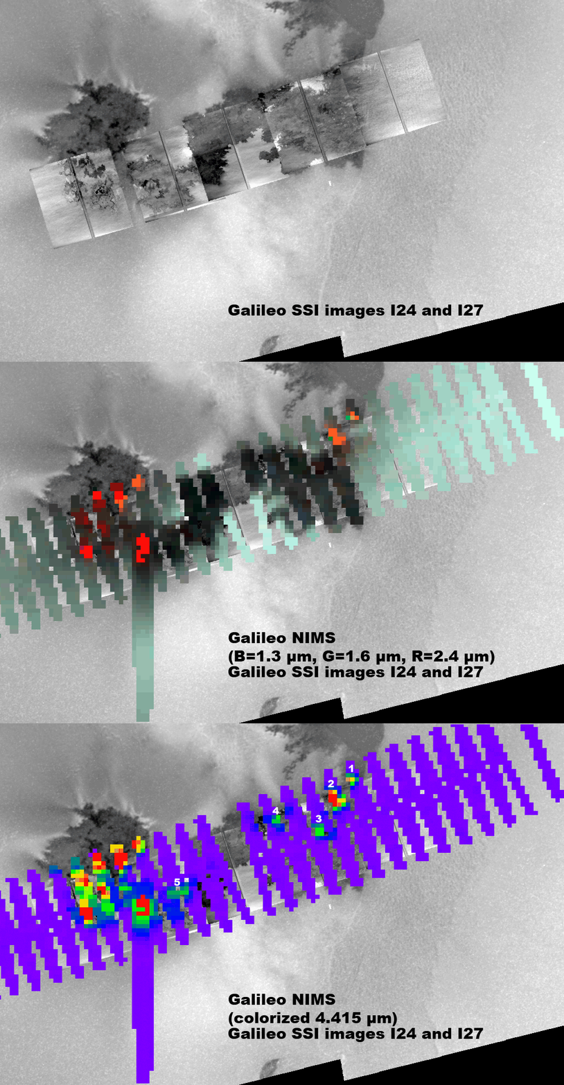
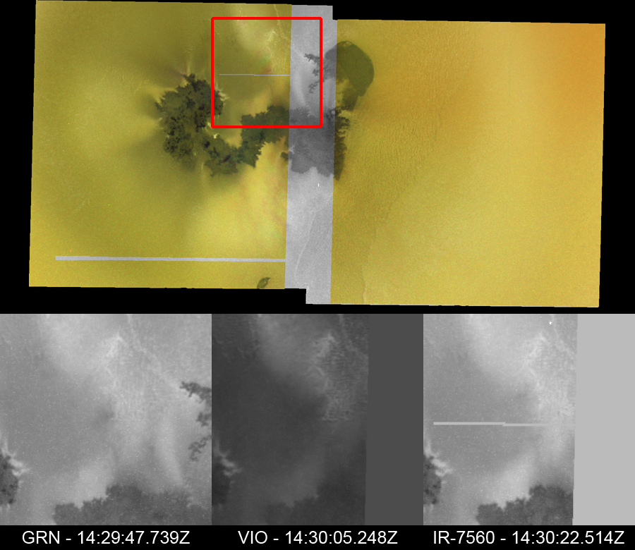
One of the key goals of this mapping project was to determine the relationship between the observed material units and the volcanic activity at Prometheus.  To help with this analysis, the authors took a look at high-resolution NIMS data from I24, which revealed several hotspots along the Prometheus flow field.  In their paper, the authors compared this data with the same I27 regional scale mosaic they used for their map, however I've gone ahead and combined that NIMS and SSI data with the SSI mosaic acquired at the same time as the NIMS data and put them together into the animated gif at right.  This animation allows for a better correlation between hotspots and dark flow units than the authors were able to find since they used SSI visible wavelength data that was acquired four months after the NIMS near-infrared data.

The authors determined that the source vent for the Prometheus flow field, rather than being located at Prometheus Patera, a volcanic depression located at the northwest end of the flow field, or along part of the western bounding scarp/fault of Prometheus Mensa, is instead located at a small lava lake estimated to be 60 meters wide at the hotspot labeled 1 in the animated gif above.  Lava erupts at this vent, along with a small, sulfur-rich plume, and flows south and west via insulated lava tubes.  Lava then breaks out from these lava tubes at several locations along the flow field.  In the NIMS data, you can see these breakouts as small hotspots, while in SSI data they are visible as dark flow areas.  Many of the breakouts are located at the western end of the flow field, akin to bird-foot delta structures in terrestrial river systems.  Lava from these breakouts covers up older dark flows which had been covered by a dusting of sulfur dioxide frost.  This frost-lava interaction is what fuels the nearly persistent volcanic plume.

Based on this scenario, Leone et al. was able to infer a possible sub-surface structure beneath Prometheus.  Based on the persistent yet episodically variable thermal emission at Prometheus, they suggest the existence of two magma chambers beneath Prometheus Patera, one located 30 kilometers below the surface near the boundary between the lithosphere and the asthenosphere, and a shallow magma chamber at a depth of 9-10 kilometers (with a roof at around 2-3 kilometers).  Magma ascends from the mantle to the primary reservoir via excess local pressure and the ascent of magmatic dikes.  From their magma travels to the shallow reservoir via a dike that uses a local thrust fault part of the way.  This thrust fault, which bounds the western edge of Prometheus Mensa, when active, would locally relieve the global compressive stresses felt in the lithosphere as the result of subsidence, helping magma ascend to the shallow reservoir.  Now based on the previous picture of volcanism at Prometheus, magma would then continue to ascend to the surface using that thrust fault.  However, with the source vent now thought to several kilometers to the west of the surface scarp, it is now thought that magma rises from the shallow reservoir via a side conduit that runs up southwest from that chamber.

Leone et al. 2009 presents a clearer picture of the volcanic history and eruption styles at Prometheus.  The authors combined a regional-scale SSI mosaic of the lava flow field (though strangely didn't deal significantly with the higher resolution data by SSI) and high resolution NIMS data to produce a geologic map of the Prometheus region.  This allowed them to generate a plausible scenario for the formation of this flow field (and the north-south trending flow field seen by Voyager in 1979) as well as the sub-surface structure beneath the volcano.

Link: Volcanic history, geologic analysis and map of the Prometheus Patera region on Io [dx.doi.org]

Sunday, October 18, 2009

Galileo's I24 Flyby of Io - A Look Back: Results

Today, we finish up our look back at Galileo's I24 flyby of Io that occurred 10 years ago last Sunday. I had hoped to get this done a few days ago but present day encounters of Titan and Tethys had taken priority.  While last week's Cassini encounters felt almost routine, though you can never presume that just because you've seen an area many times before that you won't learn something new, the flyby we've been looking back at here in this blog was definitely not so.  In our last installment, we saw how Galileo's engineers and scientists had to overcome the spacecraft going into safing hours before the flyby was to occur, scrambled images, and a stuck spectrometer grating to pull off a fairly successful flyby.

In this final installment, we take a look at some of the data that was returned by Galileo and what it taught us about Io.  To put this data in a kind of video timeline, I created a Youtube video using Celestia and put together in Adobe Premiere Pro that I posted last week.  Check it out if you haven't done so already.

SSI


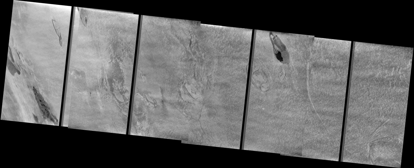
Despite the degradation of the majority of images acquired by Galileo during orbit I24, many of these images were still usable following a reconstruction effort at JPL using an alorithm in National Instrument's LabVIEW software.  For example, cooled lava flows, pits, and channels are visible in this 13-frame mosaic covering portions of the Pillan lava flow.  The eruption that formed much of the terrain visible here occurred two years earlier in a massive event that produced not only a 3100 sq. km lava flow, but also a huge pyroclastic eruption.  Lava from the eruption would then cascade over the edge of Pillan Patera (to the southwest of the area seen in the mosaic) to cover the floor of that depression with dark basaltic lava.  The rough texture, pits, and channels seen across portions of the flow field suggest potentially turbulent flow of Pillan's lavas, as well as a strong interaction been the emplaced lavas and the SO2 frost that coated the ground prior to the lava flowing over the surface.

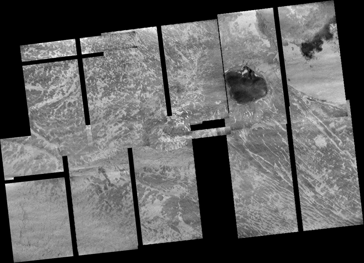
Observations at other flow fields, such as the mosaic covering Prometheus shown above, revealed a different story.  Rather than a rough textured surface, SSI images revealed a patchwork of bright, sulfur dioxide frost, fresh dark flows, and older flows.  The irregular margins of this flow field and the similar Zamama and Amirani fields suggested much thinner flow lobes (~1 meter versus 8-10 meters) than what was seen at the more rapidly emplaced Pillan flows.  These flow fields, Amirani, Prometheus, and Zamama, are interpreted to compound flood basalt flow fields.  Rather than being formed in one giant eruption, lava at these volcanoes is emplaced in the form of "small" breakouts on top of previously erupted lava.  When lava from a breakout interacts with sulfur dioxide frost on top of the older lava, the sulfur is heated up and blasts its way through the meter-thick flow lobe, helping to form part of the plumes at these volcanoes.


Several of SSI's observations were dedicated to the other major landform type on Io, its many tall mountains.  This includes the high resolution mosaic of Ot Mons, an older mountain in the middle of Colchis Regio.  This mosaic and other lower resolution observations of Io's mountains closer to the terminator to the east revealed that nearly all of these structures are at some stage of degradation.  This is despite the fact that these mountains are all less than one million years old due to Io's high resurfacing rate.  The mosaic of Ot Mons revealed a structure covered in 100-meter tall, rounded hills with a mix of bright and dark material, with the dark material located mainly in topographic lows.  The lower resolution mosaics of mountains such as Skythia Mons, Gish Bar Mons, and Monan Mons, revealed evidence for large landslides and significant faulting across the top of these mountains.  In addition to evidence for various stages of degradation, evidence for layering was observed at several mountains, including one west of Donar Fluctus (seen near the center of the ZAMAMA02 mosaic).

These SSI observations provided further evidence that Io's mountains generally consisted of tilted crustal blocks.  The observed layering would then be old lava flows, pryoclastic material, and sulfur and sulfur dioxide ices that form layers in Io's upper crust.  The observed degradation shows that these mountains begin to fall apart soon after they form as a result of sulfur dioxide sapping from those ice layers within the mountains and Io-quakes that must be fairly common.

NIMS

While NIMS, Galileo's Near-Infrared Spectrometer, was in ride-along mode for most of its observations and it lost much of its spectral resolution due to the stuck grating, it was able to make a number of exciting observations.  One of its first observations of the flyby covered portions of Loki Patera (shown at right) while the volcano was on Io's nightside.  This observation revealed warm material within fissures in the bright island on the patera floor as well as within the darker, lava lake surface to the east.  This data revealed dark material with color temperatures ranging from 305 K on the patera floor to 350 K in the island cracks.  The NIMS team determined that assuming a starting temperature of 1475 K, the temperatures correspond to surface ages of about 127 days and 39 days, respectively, suggesting that the patera floor dates back to a prior Loki eruption, while the lava in the island cracks may date from the early stages of a Loki eruption at that started in September 1999.  The uniformity of the surface temperature of the caldera floor along with PPR data taken a few minutes earlier has been used as evidence that the dark patera floor of Loki consists of one large lava lake that overturns episodically.

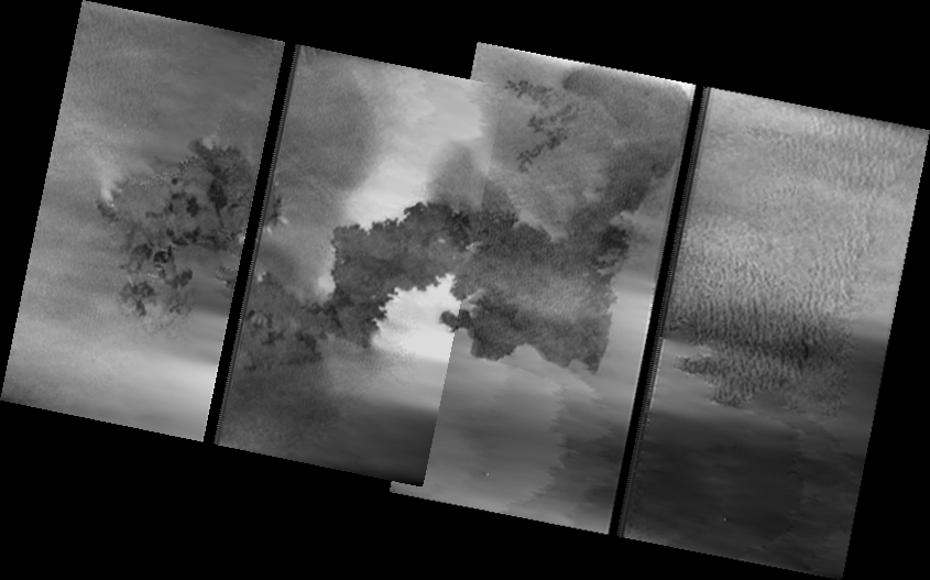
As Galileo passed Io, it was able to turn its cameras toward Io's dayside.  This allowed NIMS to examine the distribution of sulfur dioxide frost across Io's anti-Jupiter hemisphere as well as search for hotspots and examine the fine scale thermal features at several Ionian volcanoes, including Prometheus and Amirani.  For example, the image at right shows the region surrounding the volcano Prometheus.  In this data from the REGION01 observation, two hotspots are seen at Prometheus, one associated with the vent in the east and the current breakout region to the west.  Based on this and higher resolution observation, as well as co-analysis with SSI data, it has been suggested that lava at Prometheus erupts along a fissure that bounds the eastern end of the flow field.  This lava then travels west via covered lava tubes until they reach a local topographic low where the lavas then erupt again onto the surface in the form of dark breakouts.  Higher resolution data also revealed a third hotspot between the two, from an area of activity in the center of the lava flow.  The dark ring around Prometheus in the 4.2 micron data, in the middle of an SO2 absorption band, results from plume fallout, not only of the present day plume, but also from the previous eastern location of the plume, as seen by Voyager in 1979.  NIMS also used its first opportunity to image Io at high resolution to search for small and faint hotspots and observations like the one above and below revealed several of these thermal features, including the first hotspots observed at volcanoes like Tien Mu Patera and Steropes Patera.


I know I haven't covered results from Photopolarimeter-Radiometer (PPR), Galileo's mid-infrared mapper, but it is getting rather late and I want to get this post out the door.  PPR further provided coorelations between thermal emission and dark materials.  During I24, PPR observed Loki near the start of a new overturning event at the lava lake there, as evidenced by increased thermal emission near the southwestern end of the patera, where these events typically start before moving around the patera in a counter-clockwise motion.  PPR also observed older flows at Zamama and Pillan, providing estimates for the age of these flows.

I hope you have all enjoyed this look back at Galileo's I24 flyby, which occurred 10 years ago on October 11, 1999.  Galileo would go on to encounter Io five more time as it wound down its mission at Jupiter, helping to revolutionize our knowledge of this exciting satellite.

Wednesday, April 2, 2008

Reprocessed Mosaics from I27

Now that I am done with mosaicking images from I24, it is time to move on to I27. What about I25 and E26, you may ask? Well, for right now, I have all those images processed into nice mosaics. The only thing I can see doing is maybe some noise filtering and updating the color in the Culann mosaic.

For I27, I had previously uploaded mosaics of Amirani, Prometheus, the Chaac-Camaxtli region (as well as a version combined with C21 color), Tvashtar, and a cliff east of Isum Patera.

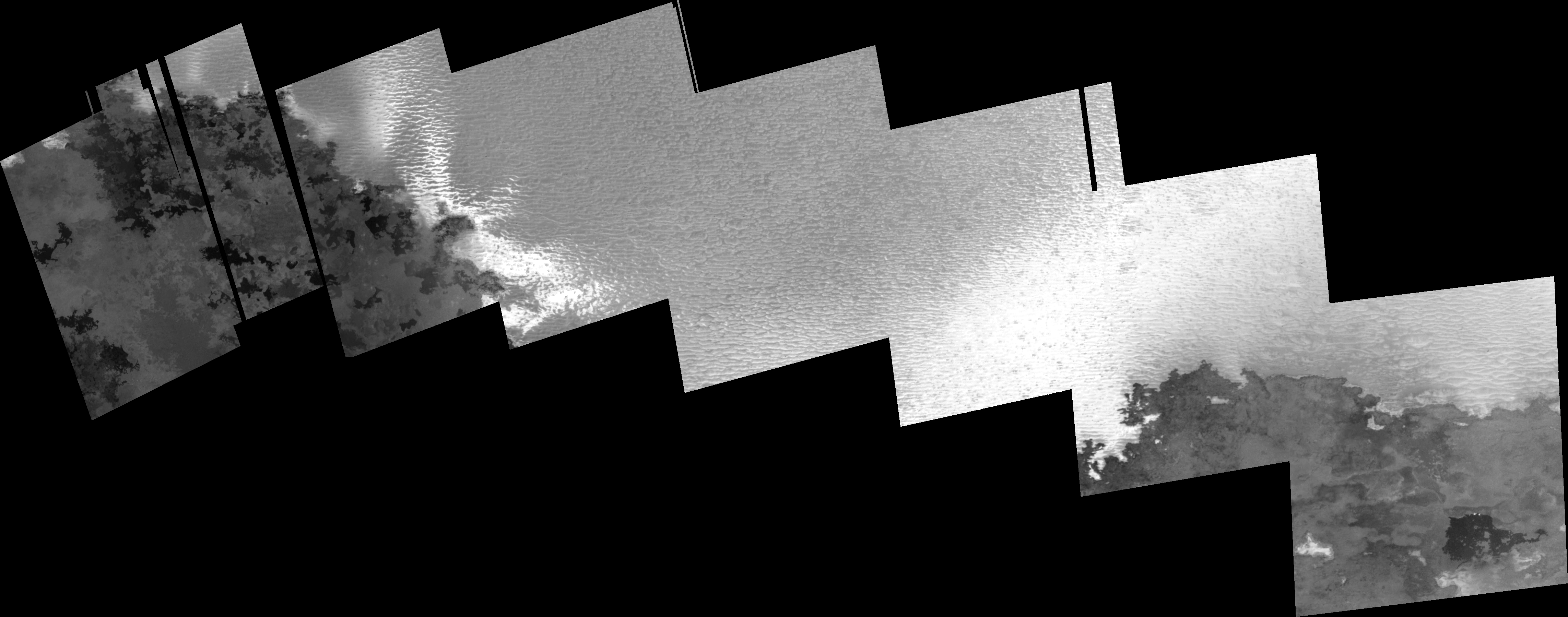
The two mosaics I worked on this time around include a high resolution view of Prometheus and environs and Tohil Mons. 27ISPROMTH01 is an eight-frame mosaic covering parts of the Prometheus flow field and the ridges just to the north of the field. Bright sulfur dioxide frost is clear visible superimposed on the ridges, blasted out from active flow fronts as the volatile is superheated after being covered in lava. The ridges are a fairly ubiquitous feature on Io's equatorial bright snowfields and are thought to be created as a response by the weak, SO2-rich surface layer to the local tidal stresses (see Bart et al. 2004). Toward the lower right of the mosaic, you can see two spots of incandescent lava. 27ISTOHIL_01 is a high-sun view of the mountain Tohil Mons (check out this I32 mosaic for a low-sun view of the same area). This observation is similar to one acquired in I24. The two mosaics allowed scientists to develop Digital Elevation Models of the mountain. The dark volcano near the center of 27ISTOHIL_01 is called Radagast Patera and the one to the northeast of that is Tohil Patera.

Sunday, March 23, 2008

Three More Mosaics from the I24 Flyby

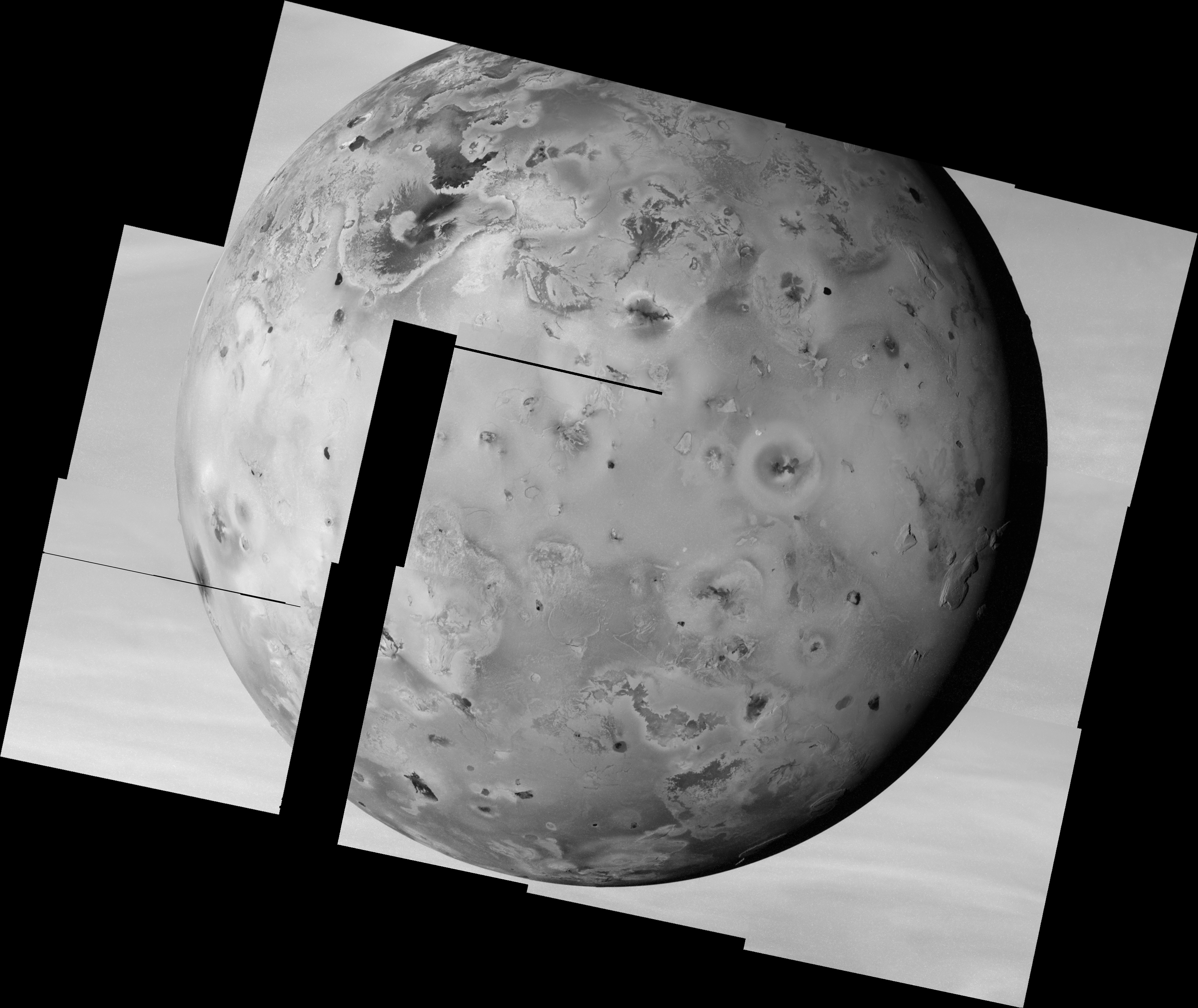
Today I got around to working on three more mosaics from Galileo I24 flyby. Like many of the mosaics from this encounter, none of these were released as complete mosaics by the Galileo project. These newly processed mosaics include: 24ISPROMTH02, a two-frame mosaic over Prometheus; 24ISTERMAP01, a six-frame mosaic covering terrain along the terminator; and 24ISSTEREO01 (left), a 12-frame nearly full-disk mosaic. With these done, I have two more observations to finish up with. I hope to have those done tomorrow or Monday.

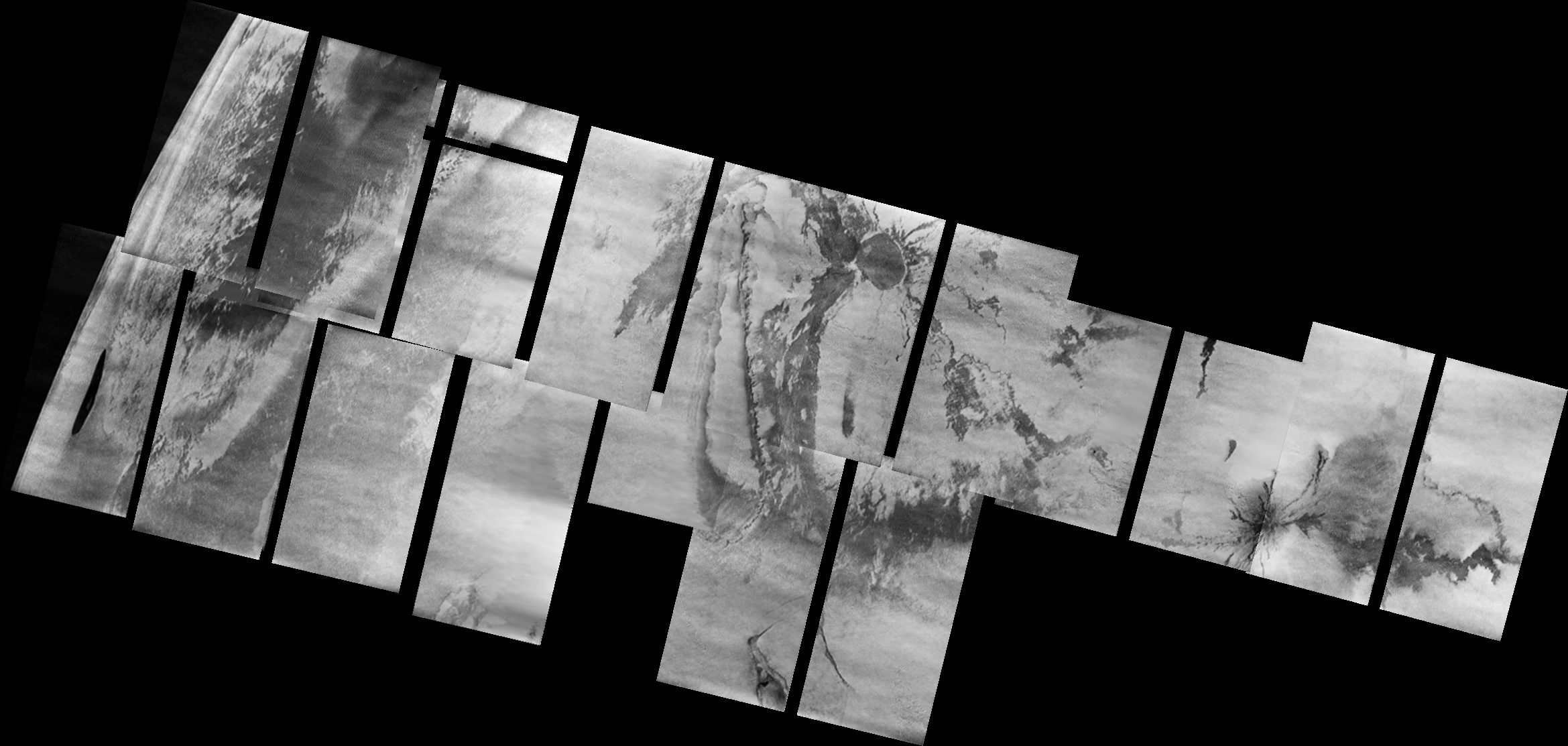
24ISPROMTH02 covers the entire Prometheus flow field as well as Prometheus Patera, a volcanic depression at the northeastern end of the flow field. The images in this observation suffer from more gradient issues and other problems than most other images, but some details can be seen in the western part of the flow field and in the low mesa to the east.

24ISTERMAP01 is a six-frame north-south strip of images along 90° West Longitude near the terminator. This mosaic covers Hi'iaka Montes near the top of mosaic, as the sun sets on those mountains, the eastern parts of Itzamna Patera, and all the way south to Ekhi Patera. Again, the quality of the reconstructed summed images is not as good as some of the earlier observations, but topography at the margins of the paterae and lineaments in this region is visible as well as hints at some of the bright flows seen in earlier views of this region. Keep in mind that in addition to being near the terminator (thus accentuating topography rather than albedo features), these images are also near the limb, so the features here are foreshortened. Ekhi Patera is actually pretty close to circular in shape. The pixel scale here is 540 m/pixel.

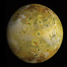
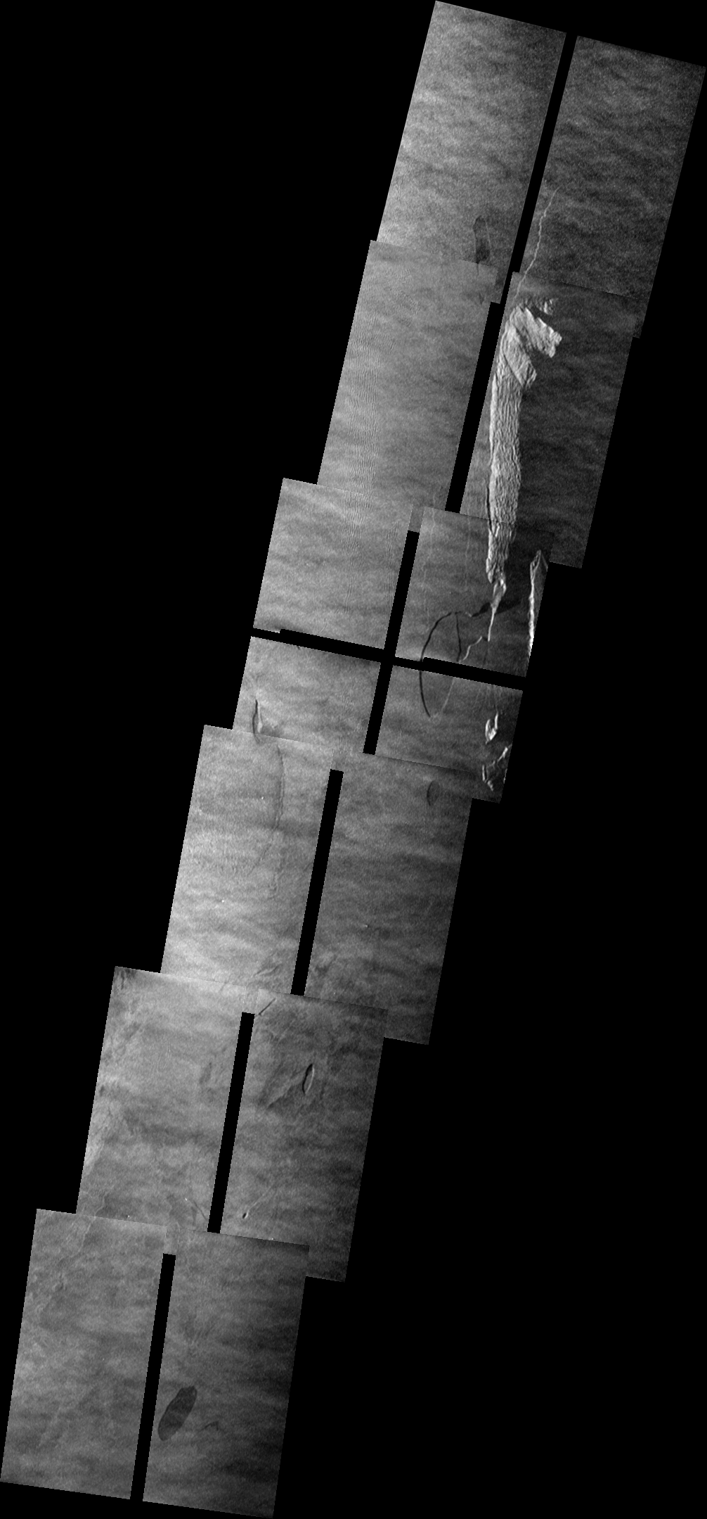
24ISSTEREO01 is a 12-frame mosaic covering much of anti-Jovian hemisphere of Io at 1.45 km/pixel, with Jupiter providing a nice background. A smaller version of the mosaic can be seen at the top of this post. Unlike the other mosaics from the I24 flyby, these images were acquired in full-frame mode. Images acquired in that mode did not suffer from the scrambling inflicted on the summation mode images during I24. This mosaic was designed as part of a stereo pair along with a similar mosaic acquired during C21 in July 1999. The relatively blandness of much of the terrain outside Io's mountains and volcanoes, plus the unusual phase functions of many of its surface materials complicate the develop of Digital Elevation Models from these two data sets.

24ISSTEREO01 covers much of the same terrain seen in the full-disk color mosaic from C21, but Io is rotated about 40 degrees to the west, allowing for terrain between 220° and 260° West Longitude to be become visible. This includes prominent volcanoes such as Pele (near lower left), Pillan (to the north east of Pele), and Isum (near upper left). Also the higher phase angle makes it easier to spot topography, particularly along the terminator near 110° West. Mountains such as Gish Bar Mons, Egypt Mons, and Boosaule Montes can also be seen along the limb against the disk of Jupiter. The mitten-shaped plateau at right near the terminator is named Capaneus Mensa.

Anyways, so I have 2 more to go.

Link: Galileo I24 Images [pirlwww.lpl.arizona.edu]

Friday, March 21, 2008

Three More Mosaics from I24

I finished up three more mosaics this evening from 1999's I24 flyby: 24ISPROMTH01, 24ISTOHIL_01, and 24ISDORIAN01. PROMTH01 covers the lava flow at Prometheus, while TOHIL_01 and DORIAN01 cover the mountains Tohil Mons and Dorian Montes, respectively.

A quick note on these images: these are the full-size mosaics. The original images were taken in 2x2 summation mode, which became corrupted before the I24 flyby. So the original raw images were 400x400 pixels in size (as opposed to 800x800 pixels for the normal mode images). As part of the unscrambling process, these images were doubled in size, to 800x800. The final unscrambled images submitted to the PDS were in that doubled size. During the course of my processing of these mosaics, I resampled each image back down to their original 400x400 size, whereas most of the released mosaics from the Galileo project left the images in that doubled form. I think by resizing the images back down to the size they were taken in, the quality of the final product is improved. So for example, you can clearly see the difference in the Pillan mosaic mentioned in the previous post between the smeared images (taken with 21-ms exposure times) and the crisper images (taken with 12-ms exposure times). I don't think this difference is as apparent in the expanded images originally released.

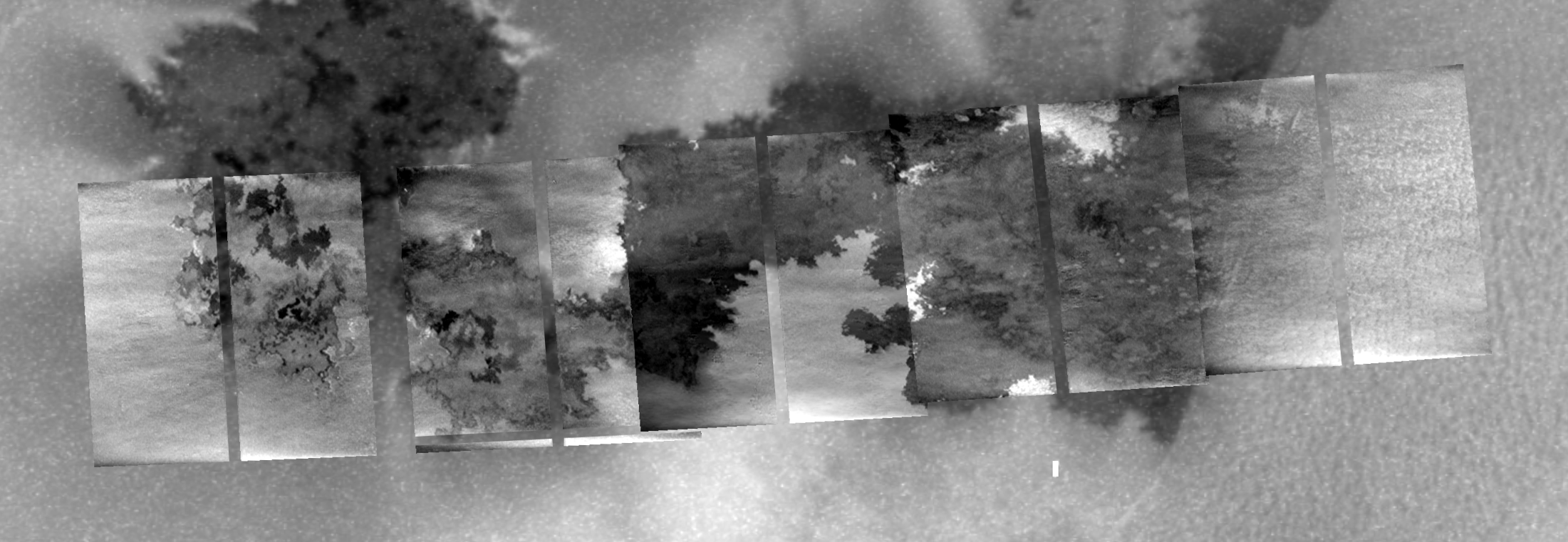
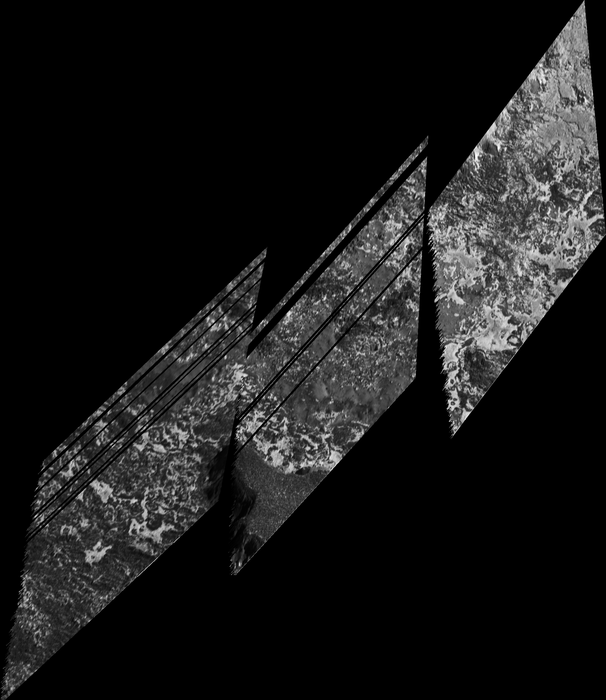
Okay, now on to the mosaics I've posted tonight. The first is 24ISPROMTH01. This mosaic covers the southern part of the Prometheus flow field and the surrounding bright terrain. The flow as crenulated margins as lava flowed around hillocks that cover the surrounding terrain before they cover them. The flow field itself is covered in numerous darker patches that represent new lava flows that hadn't yet been covered by brighter volatiles. It is rather interesting to compare the dark patches to those that show up in four months later. Many of the darker patches seen in I24 had faded while new dark flows showed up. These outbreaks are thought to be created when tubes channel lava from the main vent along a fissure at the eastern end of the flow field (seen between the last and second-to-last frame in 24ISPROMTH01) westward where the lava then emerge as sheet flows. Similar behavior was recently seen at the flows coming from Kiluaea (just imagine that channel is covered).

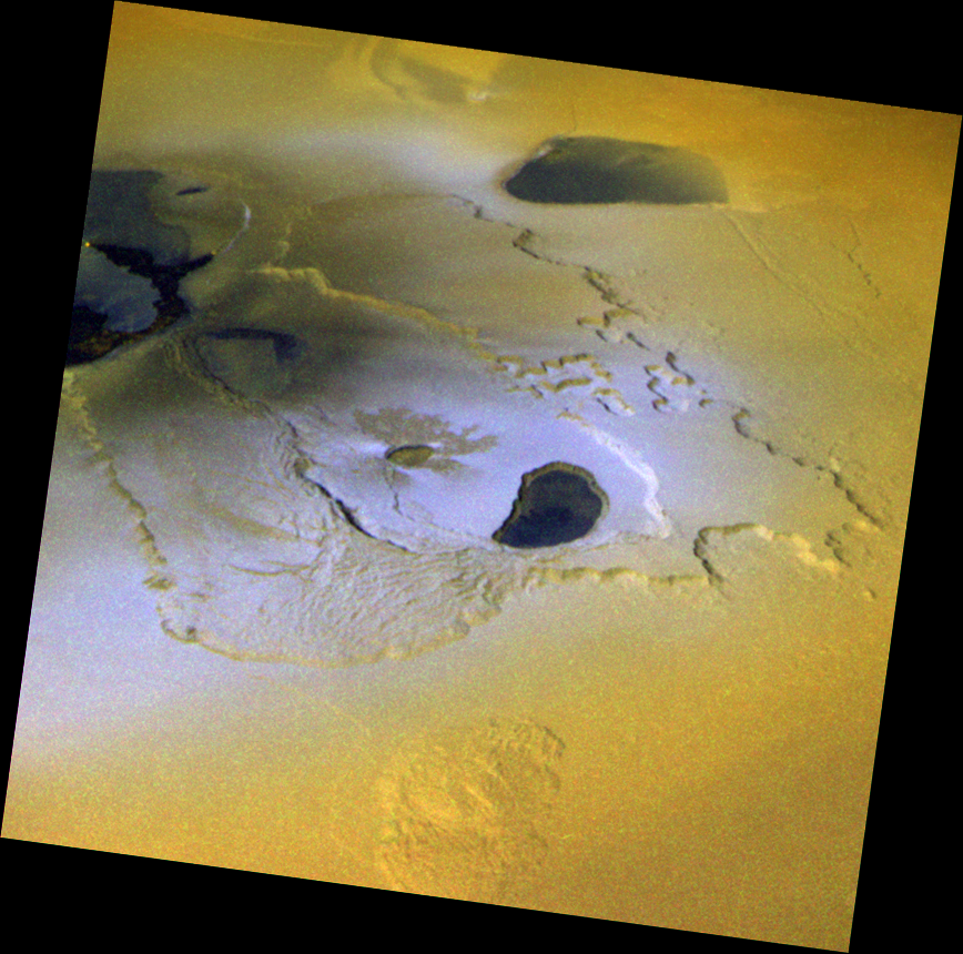
The next mosaic is 24ISTOHIL_01. This mosaic covers Tohil Mons, a 5.4 km tall mountain on Io's anti-Jovian hemisphere, and two volcanoes, Radagast Patera and Tohil Patera. Both volcanoes are in the upper right frame. Radagast is the dark, mitten-shaped depression; Tohil Patera pretty much covers the whole right side of the upper right frame. Yes, trust me, there is a mountain there. Images acquired during the I32 flyby show the area in low-sun conditions if you don't believe me. If you looks closely, you will note a small surface change within Radagast Patera, where a small, fan-shaped lava flow formed between I24 and I32. Also, comparisons between the two observations can give you an idea of what albedo patterns seen in I24 correspond to which topographic feature in I32.

Finally, there is 24ISDORIAN01. Like the Tohil observation, this shows a tall mountain (Dorian Montes) at high-sun conditions, making the mountain nearly invisible. You can still make out some topographic features that are marked by albedo markings as well. At least two volcanoes are visible in this mosaic: a pair of lava flows associated with Marduk Fluctus in the first frame and Haokah Patera in the third.

Still got plenty more to go. Stay tuned.

Link: Galileo I24 images [pirlwww.lpl.arizona.edu]

Friday, March 7, 2008

I27 Prometheus - Reprocessed (and what is that dark spot in the window?)

I ended up reprocessing a couple of mosaics from I27, the 27ISSAPPNG01 observation and the 27ISPROMTH02 observation. The later is one of my probably the least presented of the high-resolution Io color observations from Galileo. Most people know of the Tupan, Culann, or Tvashtar color sequences, but not this one as much. Not sure why, sure it has that strip where there is only green filter data, but it still looks very nice, IMHO.

27ISPROMTH02 shows the Prometheus volcano: its lava flows, patera, and plume deposits. The color here is a little stretched compared to natural color since it uses the near-infrared IR-7560 filter instead of red, along with the GREEN and VIOLET filters. Data from this observation was used to show how much new lava flowed out onto the surface between October 1999 and February 2000, indicating that the flow rate was 10 times greater than at Kilauea (a nice new flow from there just reached the Pacific, most news sites have cool video).

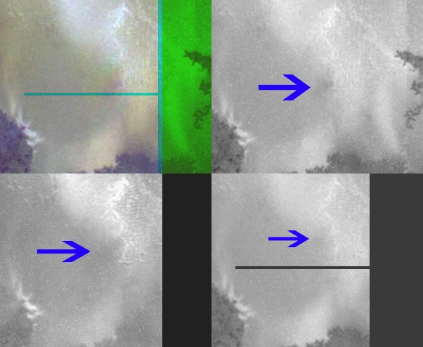
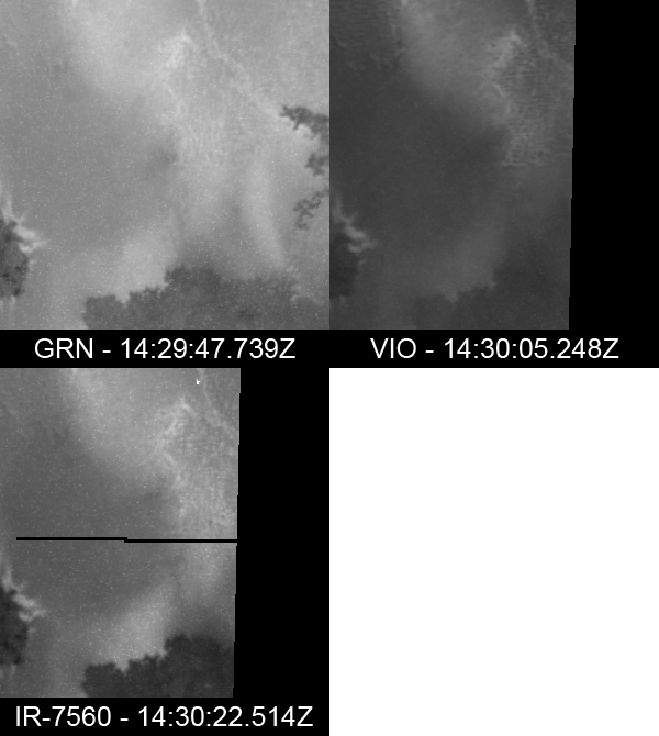
The observation also contains a rather interesting feature. There is a diffuse dark spot that moves from southeast to northwest between filters between the main patera and the western end of the Prometheus flow field. To illustrate this dark spot, I've created a little image product showing all three filter images separately and two animated gifs: one with an arrow pointing out the feature and the other without said arrow. The dark spot is near the center of each cutout. Similar moving dark features maybe seen south of the flow field. I posted on the Unmannedspaceflight.com forum about this feature last year when I first uploaded this observation on my Galileo Images of Io website. I post this again here to see what other people's thoughts are. Taking this with the possible shifting features south of the flow field, my guess is that this features is probably some kind of clump (or shadow of a clump) in Prometheus' plume. Thoughts?

Link: I27 Images [pirlwww.lpl.arizona.edu]

Thursday, March 6, 2008

LPSC 2008: Links between Volcanism and Tectonism on Io

Continuing my series of posts on the Io-related posters and abstracts for next week's Lunar and Planetary Sciences Conference, we look at Giovanni Leone et al.'s poster "Links between Volcanism and Tectonism on Io: A Comparative Study of Monan Patera, Amirani, and Prometheus". In their abstract, the authors developed models for the subsurface structures underneath Monan, Amirani, and Prometheus by looking at the tectonic structures on the surface, such as mountains and fractures, and the shapes of the paterae.

The central thesis of their work is that the same faults that act as zones of weakness that leading to the thrusting upward of the many mountains that dot the ionian landscape are also used as conduits for magma in deep-seated reservoirs to reach the surface. They used images Galileo took of these three volcanic center to model the relationship between faults, subsurface magma reservoirs, and volcanic features on the surface.

For Prometheus, their subsurface model includes three magma reservoir: a primary reservoir in the asthenosphere, a secondary reservoir at around 17 km below the surface in the middle of the lithosphere, and a shallow reservoir between 3 and 5 km below the surface. They suggest that the three reservoirs maybe connected by a thrust fault that bounds the western margin of Prometheus Mensa, a low, lumpy mesa to the east of the Prometheus volcano, and the eastern margin of Prometheus Patera. This thrust fault was the source of the N-S lava flow seen by Voyager at Prometheus and the 75-km long lava flow that developed between Voyager and Galileo. The authors suggest, based on superposition relationships between individual lava flows in the main flow field, that this thrust fault became clogged with cooled magma and a new conduit was activated on the western side of the flow field, feeding the flows that generate the main Prometheus plume. It should be noted though that thermal emission was seen by NIMS at the thrust fault as well as the western end of the flow field, so lava is exposed at the surface in both areas (at least it was eight years ago). There is also a small plume deposit reddish material emanating from the thrust fault, suggesting that it is still active as a primary vent.

Their analysis of the images of the Amirani and Monan volcanoes suggests that those two volcanoes, as well as Maui Patera, are fed by the same magma reservoir systems. Their model suggests that branching conduits from the shallow magma reservoir underneath the Amirani vent feed Maui Patera (to the southwest of the Amirani vent) and Monan Patera (to the southeast of the Amirani vent). Diapirs in the asthenosphere imping on the base of the lithosphere cause the uplifting of nearby mountains Monan Mons and an unnamed mountain to the southwest of Maui Patera. They also suggest the presence of a cold pluton (basically a solidified magma reservoir, though the term applies to any body of magma that has solidified below the surface).

A very interesting abstract. I particularly like the discussion on the subsurface connection between different volcanoes like Amirani and Monan. Such connections can be inferred in other regions as well, particularly where nearby, normally quiescent, volcanoes erupt in a relatively short span of time. Interesting examples include the volcanoes of the Tvashtar Paterae (basically four separate volcanoes partially surrounded by two mesas) and Thor.

Link: Links between Volcanism and Tectonism on Io: A Comparative Study of Monan Patera, Amirani, and Prometheus [www.lpi.usra.edu]